

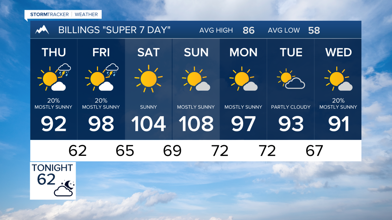


BILLINGS — Record-breaking heat is poised to dominate the forecast after a couple rounds of thunderstorms through Thursday. A few storms this afternoon and evening could become severe with hail, strong winds, and heavy rain, but attention quickly turns to a dangerous and potentially historic heat wave this weekend into early next week.
WEDNESDAY EVENING: Scattered showers and thunderstorms this evening, with the greatest coverage near the mountains and along the Montana-Wyoming border. A few storms may become severe, producing hail, damaging wind gusts, and locally heavy rainfall.
THURSDAY: Conditions trend drier across much of the region, though scattered showers and thunderstorms remain possible, especially across southern and eastern areas near the Montana-Wyoming border. Most storms should remain below severe limits, although an isolated stronger storm is possible far southeast.
FRIDAY: Building high pressure brings warmer and drier weather with increasing sunshine. Temperatures climb well into the 90s, setting the stage for a significant heat wave heading into the weekend.
SATURDAY: The heat intensifies as a strong upper-level ridge settles over the Northern Plains. High temperatures are expected to reach or exceed 100 degrees in many locations. Humidity levels fall into the teens and single digits in some areas, creating very dry conditions despite generally light winds.
SUNDAY: Potentially historic heat arrives. Temperatures above 100 degrees are expected across most of the region, with some communities potentially challenging or exceeding all-time record highs. A few locations could approach 110 degrees. Overnight lows will remain unusually warm, offering little relief from the daytime heat.
MONDAY: Dangerous heat continues with temperatures remaining near or above 100 degrees. Warm overnight temperatures in the 70s may increase heat stress, especially around Billings where buildings and pavement retain heat overnight.
TUESDAY: The ridge remains firmly in place, keeping temperatures well above normal. Highs in the upper 90s to around 100 degrees remain possible as the prolonged stretch of dangerous heat continues.
