

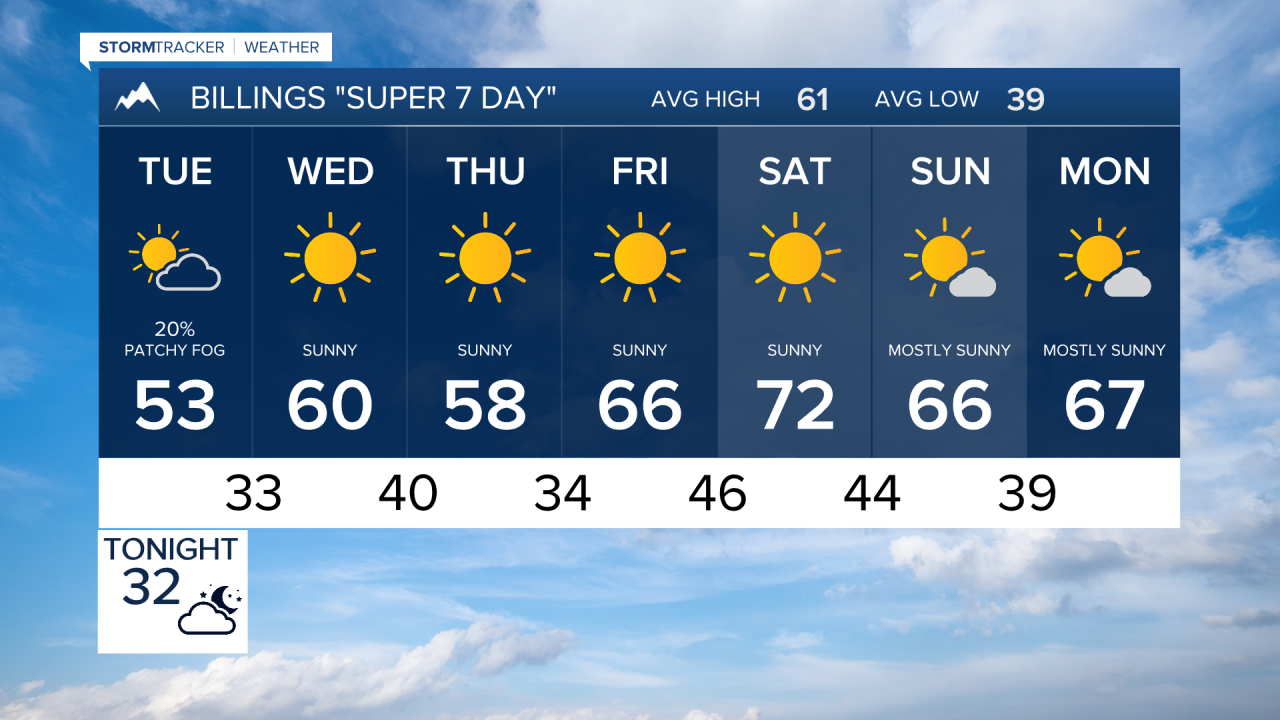

BILINGS — Cool and unsettled weather hangs on into Tuesday, with areas of rain, snow, drizzle and fog across south-central and southeast Montana and northern Wyoming. After that, conditions gradually improve, followed by a significant warm-up heading into the weekend.
TUESDAY
Another wave of moisture will keep occasional rain and snow showers around, especially across southern Montana and northern Wyoming. Some locations may see mainly drizzle or flurries, while pockets of heavier precipitation are possible.
Fog could also be locally dense early in the day. Around the Bighorn and Pryor Mountains, there is a small possibility of freezing drizzle early, including near Highway 14.
Temperatures recover about 10 degrees compared with Monday, with highs generally around the lower 50s. A few rain or snow showers may linger near the mountains south of Billings into the afternoon and evening.
WEDNESDAY
A much quieter day takes shape as the western storm system loses its influence. Most of the region stays dry with seasonable temperatures, generally reaching the 50s to lower 60s. Late Wednesday into Wednesday night, there is about a 25% chance for precipitation across far southeast Montana ahead of an approaching cold front.
THURSDAY
A mostly dry backdoor cold front moves through early Thursday, bringing a noticeable increase in northwest winds. Gusts should reach the 20s mph across much of the area, while far southeast Montana and parts of northern Wyoming could see gusts in the 30 to 40 mph range. Otherwise, expect another seasonable day with highs mainly in the upper 50s to lower 60s.
FRIDAY
High pressure begins building into the region, starting a warmer and drier stretch. Highs climb into the mid to upper 60s for many lower-elevation locations, with dry weather expected across the region.
SATURDAY
The warming trend continues, with temperatures pushing well above normal. Many locations should reach the lower to middle 70s, including Billings, with some southeast Montana locations reaching the mid 70s. Breezy winds could develop around Livingston and Nye during the morning. Otherwise, the region stays dry.
SUNDAY
A mainly dry cold front moves through, ending the stronger gap winds and bringing temperatures down slightly. It will still be relatively mild, however, with highs generally around the upper 60s to lower 70s and little precipitation expected.
