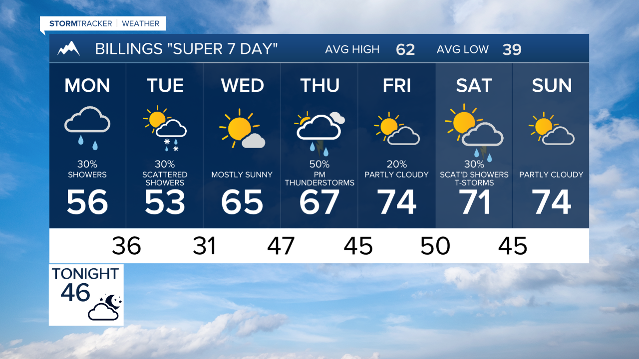

BILLINGS — SUNDAY NIGHT THROUGH MONDAY MORNING: A cold front late tonight into Monday morning brings a complete wind direction change, swinging from southerly to brisk northerly winds at 15-30 mph. Early Monday morning, showers develop over east central Montana before sunrise, then sweep south through our area. The morning commute will be rainy for some with those gusty north winds, so parents should plan accordingly for bus stops and students waiting outside.
MONDAY AFTERNOON THROUGH TUESDAY: The shower activity will focus on north-facing slopes of higher terrain, lingering into the evening hours. Temperatures take a significant tumble, with highs struggling to reach the upper 40s to mid 50s through Tuesday.
After a brief break in precipitation late Monday night, another round of energy sweeps into our region Tuesday. This brings a 40-70% chance of precipitation, mainly from Rosebud County (Forsyth) westward (including Billings) into the mountains. The air column becomes cool enough that we could see snow showers over the plains or at least a rain-snow mix, particularly over the foothills and higher hills Monday night into Tuesday.
TUESDAY NIGHT: Tuesday night brings the coldest temperatures, with overnight lows dropping into the 20s to lower 30s. This creates potential hazards for tender plants and young livestock. Most precipitation should end after Tuesday evening, though a few mountain showers may linger.
WEDNESDAY THROUGH FRIDAY: The weather pattern shifts again as ridging builds over the West Coast, placing our region under northwest flow. High temperatures climb back into the 50s and 60s Wednesday, then 60s to lower 70s Thursday through Friday. Overnight lows rebound to the upper 30s and 40s. Thursday brings another chance of showers and thunderstorms as a weak disturbance tracks through the northwest flow.
