

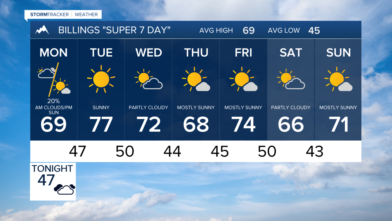


BILLINGS — Periods of showers and a few thunderstorms will continue into Monday, especially across southeast Montana and the mountains. Then a warmer, much drier pattern takes over for most of the week.
SUNDAY NIGHT
Scattered showers and isolated thunderstorms will move through south central and southeast Montana tonight. The best chance for precipitation will be along the Montana-Dakotas border and over the Beartooth and Absaroka Mountains. A few stronger storms could produce heavy rain, small hail and gusty winds, with the most favorable window for thunderstorms from about 9 p.m. through 6 a.m. Monday.
MONDAY
A few showers and isolated thunderstorms remain possible, mainly over the higher terrain and southeast Montana. Low clouds or patchy fog could develop early in parts of southeast Montana before drier air begins moving in later in the day. Highs will generally reach the upper 60s to lower 70s, with Billings near 70.
TUESDAY
Warmer and drier weather settles across the region as the flow turns west to northwest. Afternoon temperatures climb into the middle and upper 70s, with Billings around 77.
WEDNESDAY
Dry weather continues, but temperatures cool somewhat. Highs will generally be around the upper 60s and lower 70s, including near 72 in Billings.
THURSDAY
The quiet and dry pattern continues. Temperatures remain seasonable, with highs mostly in the mid to upper 60s and Billings around 68.
FRIDAY
Still mild and primarily dry, with temperatures rebounding into the lower 70s. Billings is forecast to reach around 74.
SATURDAY
The generally mild pattern continues into the weekend. Highs are forecast mainly in the mid to upper 60s across the region, with Billings around 66.
