

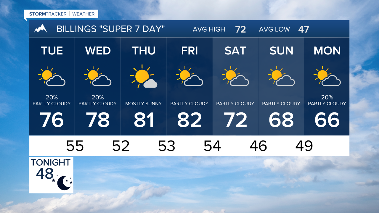

BILLINGS — A beautiful stretch of early autumn weather is setting up across south central and southeast Montana and northern Wyoming. Warm temperatures and mainly dry conditions will dominate through much of the week before a stronger Pacific weather system arrives late Friday into the weekend with increasing winds and cooler temperatures.
MONDAY OVERNIGHT
Some areas of fog will redevelop. Visibility for your morning commute could be affected. Lows mainly in the 40s.
TUESDAY
Warm weather continues as southwest flow increases aloft. Most areas will remain sunny to partly cloudy with temperatures running above normal reaching highs in the 70s. Conditions stay dry for the majority of the region, although a few clouds may begin increasing across the mountains later in the day. Isolated storms are possible overnight into Wednesday morning.
WEDNESDAY
Temperatures remain well above seasonal averages, making this one of the warmer days of the week. Most communities across south central and southeast Montana and northern Wyoming stay dry. An isolated shower or thunderstorm cannot be ruled out near higher terrain, but widespread precipitation is not expected.
THURSDAY
Little change is expected. Warm afternoons, cool mornings, and mainly dry weather continue under a persistent southwest flow pattern. High temperatures may run 10 to 15 degrees above normal in some locations hitting 70s to mid-80s.
FRIDAY
Weather conditions begin to change as a Pacific storm system approaches the Northern Rockies. Winds will increase during the day, especially along exposed ridges and foothills. Clouds become more common, while temperatures remain mild ahead of the approaching cold front.
SATURDAY
The strongest impacts of the incoming system are expected during the weekend. A cold front is forecast to sweep across the region, bringing gusty winds and noticeably cooler temperatures. While forecast timing remains somewhat uncertain, confidence is increasing that a significant cool-down and breezy conditions will affect much of the area.
SUNDAY
Fall-like weather settles back into the region. Cooler temperatures continue with lingering breezy conditions possible, though the strongest winds should gradually diminish. Conditions trend drier as the weekend system exits the Northern Rockies.
