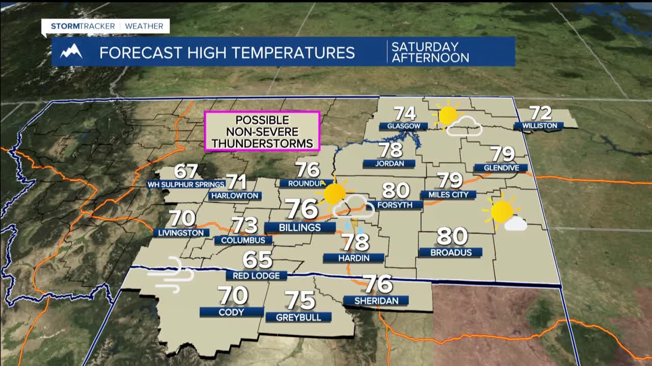


BILLINGS — SATURDAY: It will be the warmest weather of the forecast period, with highs soaring into the 70s and approaching 80 degrees, especially east of Billings. The beautiful morning and early afternoon weather takes a turn as a weather system approaches from California. Increasing moisture and instability create the potential for showers and weak thunderstorms during the late afternoon into evening.
Any storms that do form could produce gusty winds up to 45 mph in stronger cells, with relative humidity dropping into the upper teens to mid-20s creating elevated fire weather concerns.
SUNDAY THROUGH TUESDAY: A cooler and more unsettled pattern unfolds as a slow-moving trough works through the Rocky Mountains. Expect periods of rain showers at lower elevations with mountain snow above 7,000 feet. Multiple rounds of precipitation will linger through Tuesday.
Rainfall amounts will generally range from 0.10 to 0.30 inches, though locally higher amounts are possible. Mountain areas could see 2-6 inches of new snow. Temperatures cool, with highs in the 60s to near 70 Sunday, then dropping to the upper 50s to mid-60s Monday and Tuesday.
WEDNESDAY THROUGH FRIDAY: A more organized and potentially colder weather system impacts us as early as Wednesday. This system appears more substantial than the earlier-week weather, offering a 40-60% chance of widespread precipitation that could include wet snow at lower elevations.
Temperatures will be noticeably cooler under this system's influence, though specific details remain uncertain given the extended time frame. Right now it looks like highs may be int he 40s and lows in the 20s by late next week.
