

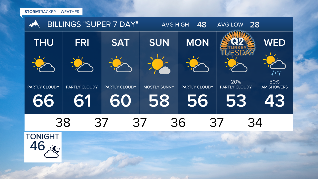

BILLINGS — Mostly dry and unusually mild weather will continue across south-central and southeast Montana and northern Wyoming through the weekend. Wind will be the main concern, first near the western foothills Wednesday and then across far eastern Montana Friday and Saturday. A more significant change toward cooler and potentially wetter weather may arrive next week.
THURSDAY
Dry and remarkably mild weather continues, with many locations reaching the 60s. Billings and Hardin are forecast for mid-to-upper 60s, while Sheridan could approach 70 degrees. Far eastern Montana may be somewhat cooler depending on the position of high pressure over the Dakotas. There is also a small chance of fog in far eastern Montana early Thursday morning.
FRIDAY
Temperatures remain above normal, generally in the 50s and lower 60s. Winds become a bigger concern across far southeast Montana as a stronger pressure gradient develops. Carter (Ekalaka) and Fallon (Baker) counties could see southerly wind gusts of 35 to 45 mph. Elsewhere, conditions remain predominantly dry.
SATURDAY
The mild and dry pattern continues. Highs should again range through the 50s and lower 60s. Gusty southerly winds of 35 to 45 mph remain possible across far eastern and southeast Montana, especially Carter and Fallon counties.
SUNDAY
Temperatures remain above normal, with highs primarily in the mid to upper 50s. Winds across eastern Montana should gradually decrease as high pressure shifts farther east. Dry weather remains dominant across south-central and southeast Montana and northern Wyoming.
MONDAY
Little immediate change is expected, with another mostly dry and mild day. Highs remain mainly in the 50s, with some locations near 60 degrees. Attention begins turning toward an approaching upper-level system that could eventually break down the prolonged mild and dry pattern.
TUESDAY AND BEYOND
A pattern change becomes possible Tuesday into Wednesday as an upper-level trough approaches the region. This could bring cooler temperatures along with renewed precipitation chances. Current guidance shows about a 20 to 30 percent chance of receiving more than one-quarter inch of precipitation from the system, but considerable uncertainty remains regarding its track and strength.
