

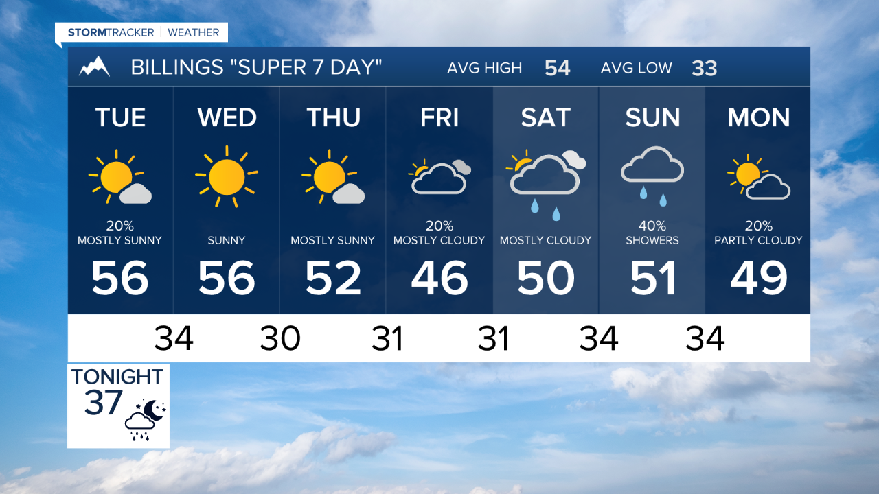

BILLINGS — A quick-moving system brings showers and mountain snow tonight into Tuesday, followed by gusty winds. The rest of the week turns mainly dry with seasonable temperatures before another chance for unsettled weather develops late in the weekend.
MONDAY NIGHT
Rain and mountain snow showers spread from west to east tonight, reaching Billings after midnight and continuing toward southeast Montana. A few thunderstorms are possible. A few inches of snow could fall above 7,000 feet in the Crazy and Beartooth/Absaroka Mountains, with some snow briefly mixing into the foothills.
Bozeman Pass could see a period of difficult travel this evening. Far southeast Montana has about a 40% chance of fog overnight.
TUESDAY
Showers gradually move east and taper during the day. The bigger story becomes the wind, with west gusts generally 20 to 40 mph and 40 to 50 mph along the western foothills. Highs range from the upper 40s to upper 50s, with some lower 60s around Hardin. Winds ease Tuesday evening.
WEDNESDAY
Dry weather returns for most lower elevations with seasonable temperatures. Highs are mainly in the 50s, including the upper 50s around Billings and Miles City and near 60 around Hardin.
THURSDAY
Another mainly dry day is expected across south-central and southeast Montana and northern Wyoming. Occasional showers remain possible mainly in the western mountains and foothills. Highs stay in the 50s, with breezy conditions possible at times.
FRIDAY
Most lower elevations remain dry, although temperatures cool slightly. Look for highs generally from the upper 40s to mid-50s across the region.
WEEKEND
Saturday remains mainly dry across the lower elevations with highs mostly in the 50s, although some mountain and foothill showers are possible. By Sunday, chances for rain and snow showers begin increasing as a larger weather system approaches the Northern Rockies, potentially bringing a more unsettled pattern into early next week.
