

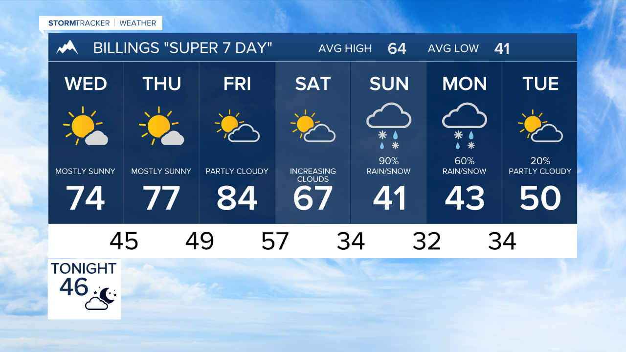

BILLINGS — Very warm and dry weather continues through Friday, with elevated fire concerns. Much colder weather, rain and mountain snow are likely while wet snow could reach lower elevations, including Billings.
WEDNESDAY
Dry and mostly sunny weather continues across south-central and southeast Montana and northern Wyoming. Temperatures remain well above normal, generally reaching the 70s, with Billings around 74. Winds turn more easterly behind Tuesday’s weak front.
THURSDAY
Another warm and dry day is expected with highs mainly in the 70s to around 80. Billings is forecast near 77, while Livingston could reach around 80. Fire concerns remain elevated because of the continued stretch of warm and dry weather.
FRIDAY
Temperatures surge ahead of the approaching cold front, with widespread highs in the lower to middle 80s. Billings is forecast around 84, with Hardin near 84 and Sheridan around 85. Increasing winds and lower humidity could create critical fire-weather conditions, with gusts around 40 mph possible along the western foothills.
SATURDAY
A strong cold front brings the beginning of a major pattern change. Temperatures will fall sharply, with the warmest readings likely early in the day. Highs range from the mid 60s around Billings and Livingston to lower 70s farther east and south. The chance for precipitation begins increasing as a deep storm system develops over the West.
SUNDAY
Much colder and wetter weather settles across the region. Highs fall into the 40s for much of the area, with some locations only reaching the upper 30s. Mountain snow looks increasingly likely, while lower elevations across the western half of the region, including Billings, could see wet snow or some accumulation. Current probabilities for at least one inch of snow range from 20 to 40 percent across central lower elevations, including Billings, and 65 to 75 percent along the western foothills.
MONDAY
The storm system could continue affecting the region with cold temperatures and additional rain or snow. Highs generally remain in the 40s to around 50. There is still considerable uncertainty in the storm’s track, precipitation amounts and snowfall potential, so it is too early to pin down specific accumulations. A favorable storm track could produce significant snowfall in parts of the region, but another track could keep lower elevations warmer with considerably less snow.
