

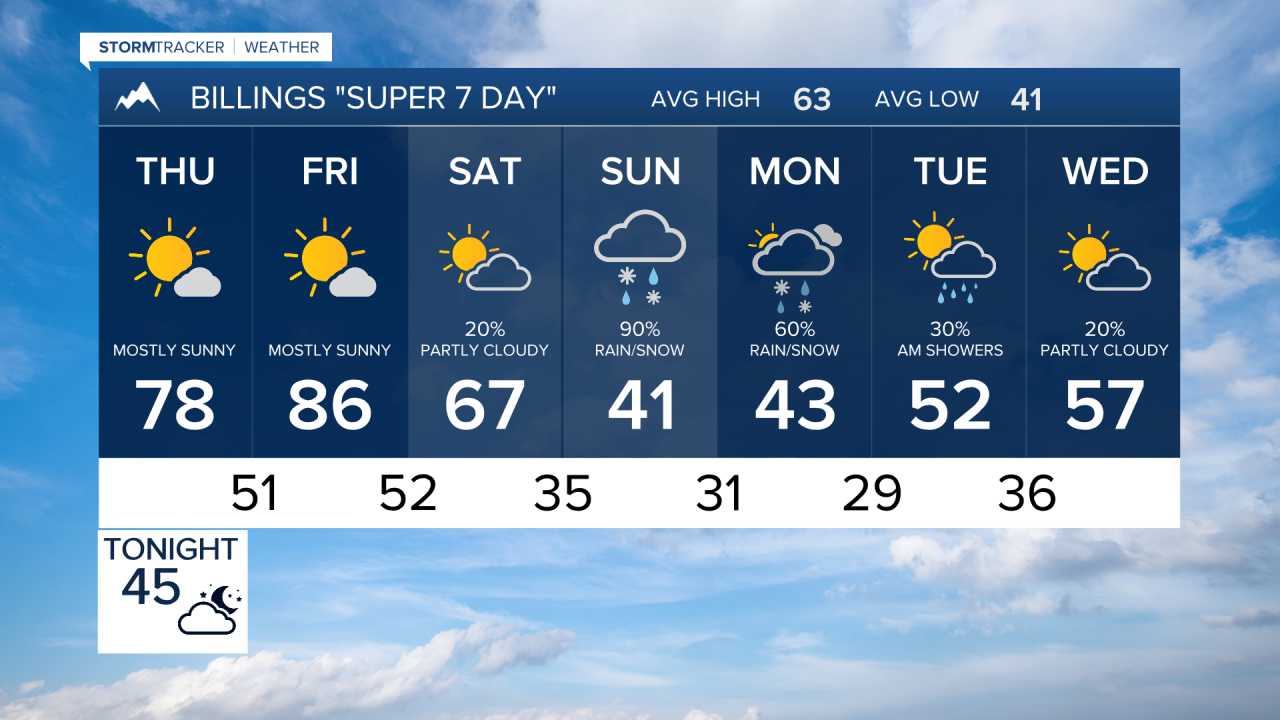

BILLINGS — Very warm and dry weather continues through Friday, but a major fall pattern change arrives this weekend. Friday could bring critical fire weather before a cold front sends temperatures tumbling, followed by rain, mountain snow and potentially the first widespread frost of the season.
THURSDAY
Another very warm, dry day is expected. Temperatures remain well above normal, with occasionally breezy conditions helping maintain elevated fire concerns.
FRIDAY
The warm spell peaks with highs reaching the 80s across much of the region. Humidity drops into the single digits and teens while winds increase, with gusts generally in the 20 to 30 mph range. Elevated to critical fire weather conditions are possible, particularly along the foothills west of Billings where gusts could exceed 40 mph.
SATURDAY
A dramatic change begins as a cold front moves through early Saturday. Temperatures turn cooler and moisture increases as the first part of a stronger weather system reaches the region. Rain develops in some lower elevations, while snow becomes increasingly possible in the mountains and foothills Saturday night.
SUNDAY
Much colder and wetter weather settles in. Highs may struggle through the 40s, while widespread precipitation continues. Snow is favored in the mountains and foothills, especially west of Billings, with rain and wet snow possible at lower elevations.
The Absaroka-Beartooth and Crazy Mountains could see their first heavy snow of the season, while the foothills west of Billings and Bighorn Mountains could also receive accumulating snow. A widespread frost becomes possible by Sunday morning.
MONDAY
Mountain and foothill snow remains possible, with rain and wet snow at lower elevations. Areas west of a Roundup-to-Sheridan line currently have the greatest potential for significant precipitation. Temperatures remain chilly, with highs generally in the 40s and another widespread frost possible during the morning.
TUESDAY
The chilly fall pattern continues, with temperatures remaining well below the warmth experienced late this week. This looks to be the coolest air mass of the fall so far, although considerable uncertainty remains regarding exactly how long precipitation lasts and how much snow ultimately accumulates, especially at lower elevations.
