

BILLINGS — When it comes the snowfall, Billings got the short end of the stick again Wednesday night. Billings only wound up with 1 inch of snow. Other places like Red Lodge got up with 10 inches of new snow.
We are expecting more snow to move in this weekend, but it looks like the lion’s share will continue to stay to the north and west of Billings.
At 2 p.m. Thursday, it was 34 degrees in Billings. Around the rest of the state, the temps are mostly into the 30s and 40s, with some of the 40s out in the far west, while Jordan and Livingston both continue to be right in the low 40s.
We have a Winter Storm Warning for north-central Montana for various amounts of snowfall ranging from 3 to 6 inches in Meagher County to 10 to 16 inches of snow up around Glacier National Park.
On either side of that we have a Winter Storm Watches, and Winter Weather Advisories, also for various amounts of snow that range from 1 to 3 inches near Kalispell up to 3 to 8 inches of snow around Glasgow.
Butte and Helena could see 2 to 5 inches of snow.
Plus, we still have small stream flood advisories for the northeast corner of the state where recent snowmelt runoffs are causing the water levels to rise to near flood stage.
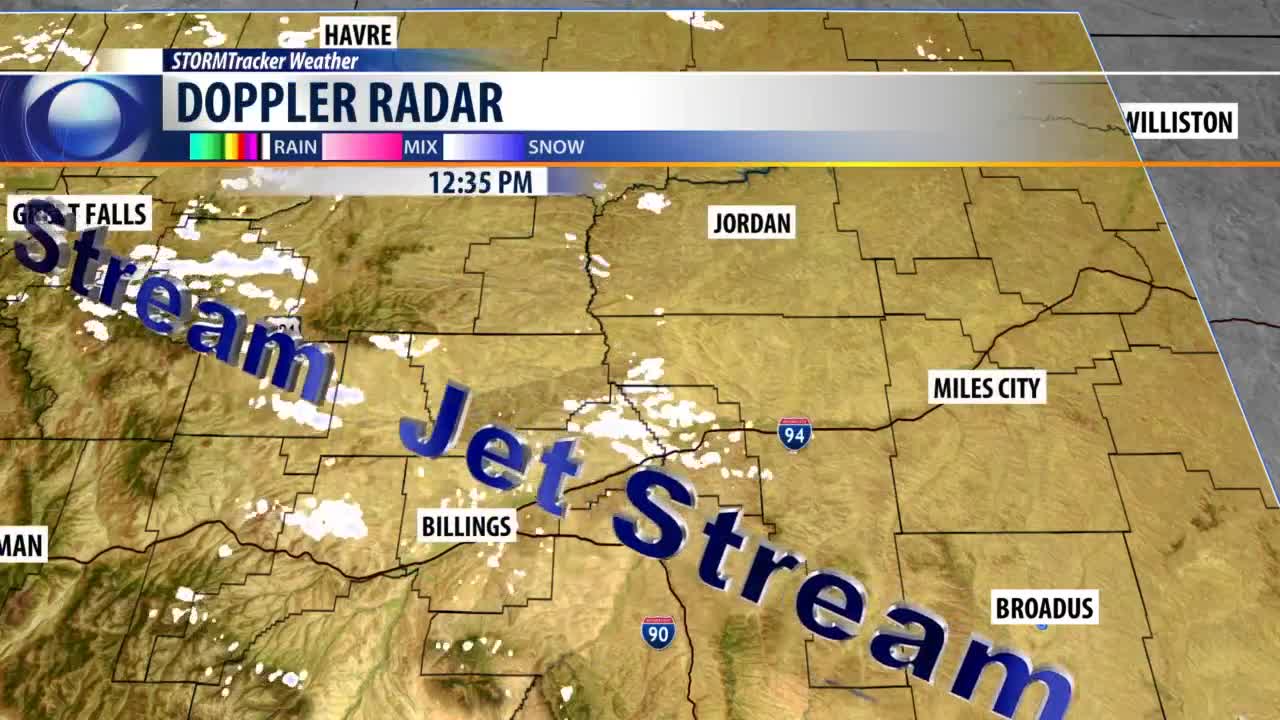
Right now, the jet stream’s taking a northwesterly flow of air grabbing some scattered snow showers and just spreading all around the Billings area but not so much in downtown Billings.
Plus there's another batch of snow between Great Falls and Havre that continues to be spotty and scattered.
The high-resolution forecast model shows a new cold front dropping down from Canada Thursday night into Friday morning. But so far it looks like most of the snow continue to stay up in the Northwest corner the state.
Then on Friday and Saturday that cold front will drop all the way through Montana, but a fresh batch of moisture streams in from the Southwest and continues to pump more snow up into the Beartooths and to the north-central part of the state.
Essentially the snow will be doing an end around the Billings area through Saturday afternoon.
Snowfall amounts this weekend will range from 1 to 2 inches of snow in Billings, all the way up to 14 to 20 inches of snow by Cut Bank.
However, tonight we will see the temperatures drop in the 30s, down into the upper 20s in the morning and get back up to the upper 30s, about 2:30 p.m. Friday afternoon.
Our high temperatures will dip from the 40s on Friday down into the low 20s on Sunday back up to the low 40s again on Tuesday and hang around 35 degrees on Wednesday.
BILLINGS FORECAST
TONIGHT: Partly cloudy and cool. North winds 5 to 15 mph. Low 27 degrees.
FRIDAY: Mostly cloudy with a 20% chance for snow in the afternoon. East winds 10 to 20 mph. High 41 degrees.
SATURDAY: Mostly cloudy with a 40% chance for snow in the afternoon and 80% chance for snow that night. Snow accumulations of 1 to 2 inches are possible. Northeast winds 5 to 15 mph high 43 degrees.
