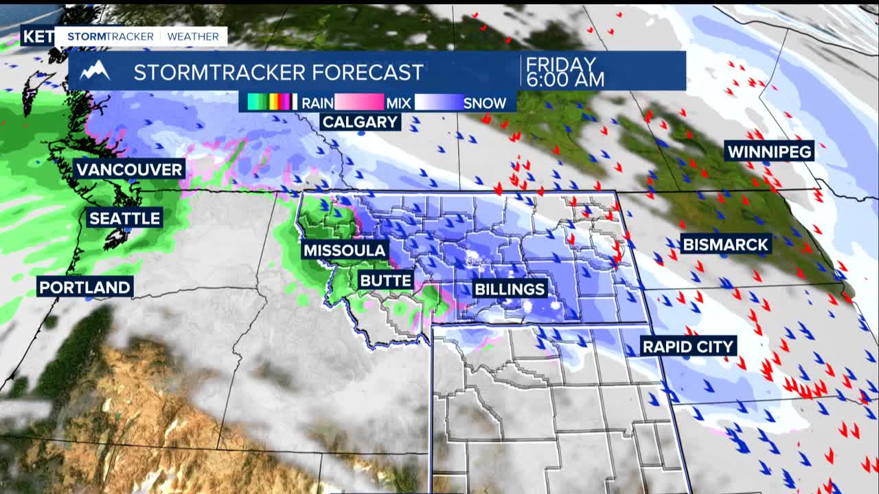


BILLINGS — Eastern Montana is about to get hit with a significant winter storm that will bring dangerous travel conditions and heavy snow to much of the state. Northern Wyoming gets more of a glancing blow.
A cold front moving through Thursday afternoon and evening is causing temperatures to drop rapidly. Rain will quickly change to snow throughout the evening, and any wet roads could freeze very quickly, creating extremely slippery driving conditions.
The heaviest snow with a potential of 5-10 inches will fall across the plains from Harlowton to Billings and east toward Miles City and Ashland. Isolated areas could see up to 12 inches. The mountains, especially the Crazy Mountains, could get 10-18 inches.
The heaviest snow starts Thursday night and will continue through Saturday morning. Snow should wind down by Saturday afternoon.
Expect cold temperatures, especially on Friday and Saturday when highs may only reach single digits to teens from Billings to the east. Cold air will settle in the lower elevations, and higher elevation communities could still each the 20s and 30s.
Roads and sidewalks could be extremely dangerous tonight through Saturday, especially in areas where ice will be covered with snow.
Warmer and drier weather returns Sunday with temperatures climbing back into the 40s and 50s. Expect a lot of snow melting over the weekend and early next week.
