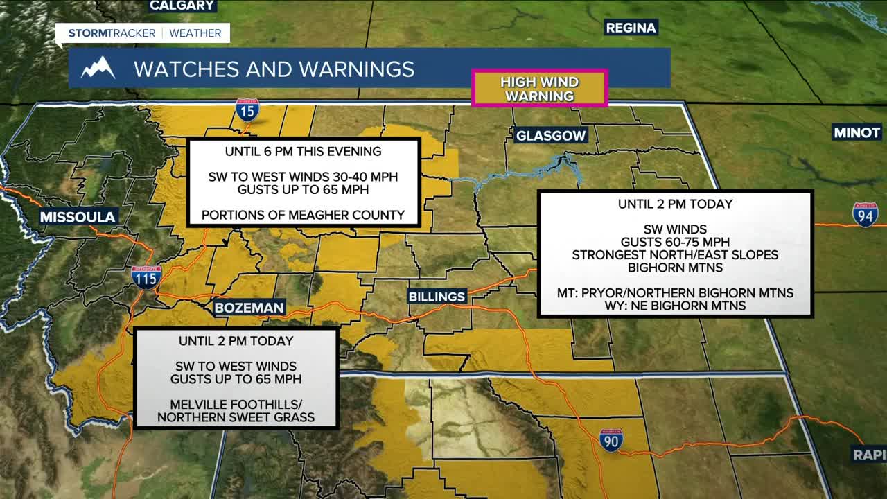


BILLINGS — An active weather pattern continues across the region. Strong winds ramped up overnight along the foothills, especially near the mountains where mountain wave winds have developed. Gusts have reached 70 to 80 mph near Livingston, with 50-60 mph gusts elsewhere along the western foothills. These strong winds will continue through the morning, then spread east into central areas with gusts of 30-45 mph.
A warm front moving through early today is bringing the chance for mixed precipitation across far eastern Montana. The greatest freezing rain threat is in Fallon County, where a Winter Weather Advisory remains in effect through this morning.
Later this afternoon and evening, a cold front drops in from the north. This will shut down the strong winds, but it will bring a quick-moving band of rain and snow that transitions to all snow. While this system moves through fairly fast, travel impacts are possible for the Friday evening commute, especially along the southern foothills. Upslope winds could lead to brief periods of moderate to heavy snow, and gusty northerly winds may cause blowing snow and reduced visibility. Most lower elevations will see a dusting to under an inch, but a few inches are possible along the Beartooth front, including Red Lodge, and along the east side of the Bighorns and Pryors. Winter Weather Advisories are in effect for those foothill areas from late this afternoon through midnight.
In the Absaroka-Beartooth Mountains, snow continues through Saturday as steady Pacific moisture remains locked in. A Winter Storm Warning remains in effect through early Saturday, with 1 to 2 feet of snow expected, mainly on west- and south-facing slopes. Winds gusting up to 75 mph could also result in significant blowing snow at times.
Behind the front, cooler air settles in Saturday, with highs mainly in the 30s and 40s. Looking ahead, zonal flow returns next week, keeping temperatures above normal. Periods of Pacific moisture will continue to bring mountain snow, and gusty winds will occasionally impact the foothills.
Also, a reminder that winter arrives on Sunday morning at 8:03 AM.
Miller Robson
Q2 Morning Meteorologist
miller.robson@ktvq.com
