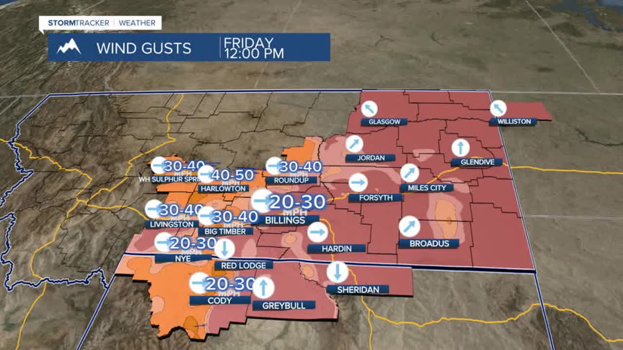


BILLINGS — Strong winds up to 60 mph are expected along the western foothills on Friday, where a Wind Advisory remains in effect until noon. Gusts of 30 mph or more will be possible across the rest of the area. Some locations could see light rain while the mountains could pick up a few inches of snow through tomorrow morning Highs will be mainly in the mid-50s.
A cold front moving through Friday night into Saturday morning may bring a light dusting of snow, up to an inch, to areas east of Hardin by early Saturday. Gusty winds of 30–40 mph are also expected across much of that area during that time, which could reduce visibility. High pressure moves in by Saturday afternoon and dry conditions are expected through next week.
Cooler temperatures will settle in through the weekend before above-average temperatures return Monday through the rest of next week.
Daytime highs will range from the 40s west to the 30s east on Saturday, from the mid-50s west to the mid-40s east on Sunday, then the 50s and 60s next week.
Nighttime lows will be in the 20s and 30s on Friday night, mainly 30s on Saturday night, 20s and 30s on Sunday night, 30s and 40s on Monday night, then mainly 30s midweek.
Miller Robson
Q2 Morning Meteorologist
miller.robson@ktvq.com
