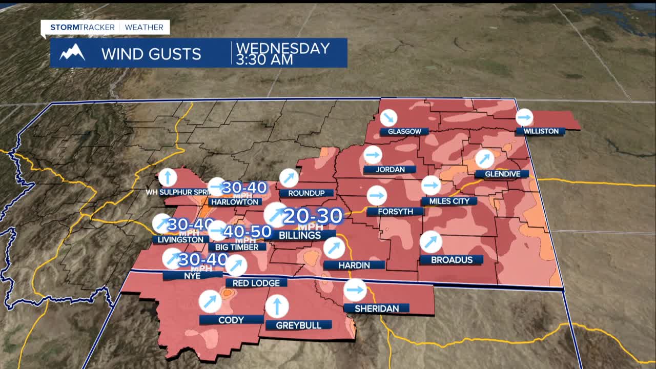


BILLINGS — Strong winds are battering the foothills west of Billings and will continue through Wednesday, with gusts reaching 35 to 55 mph. Travelers should use extra caution on Interstate 90 between Livingston and Big Timber, and on US Highway 191 from Big Timber to Harlowton.
The overall weather pattern for the week looks quite pleasant for most areas, with temperatures running warmer than normal and mostly dry conditions expected. High temperatures will reach the upper 40s to lower 50s in western areas, while eastern locations will see mid-30s to lower 40s.
A weather system passing through Wednesday will bring slightly cooler air to southeastern Montana, dropping temperatures about 5 degrees that afternoon, but the change will be brief.
Light snow may return to the mountains starting Friday and continuing into the weekend. The south and west-facing slopes of the Absaroka-Beartooth Mountains could see some accumulation, but the plains and lower elevations should remain mostly dry.
The windy conditions are caused by a weather pattern that has high pressure to the west and low pressure to the east, creating downslope winds that warm up as they descend from the mountains. This same pattern is keeping most precipitation away from the lower elevations.
