


BILLINGS — Strong winds will continue across much of the area through Friday afternoon. Gusts over 60-56 mph remain possible, especially in lower elevations and across eastern areas. Winds will ease from west to east as the day goes on, but strong winds could linger into the evening in our eastern counties.
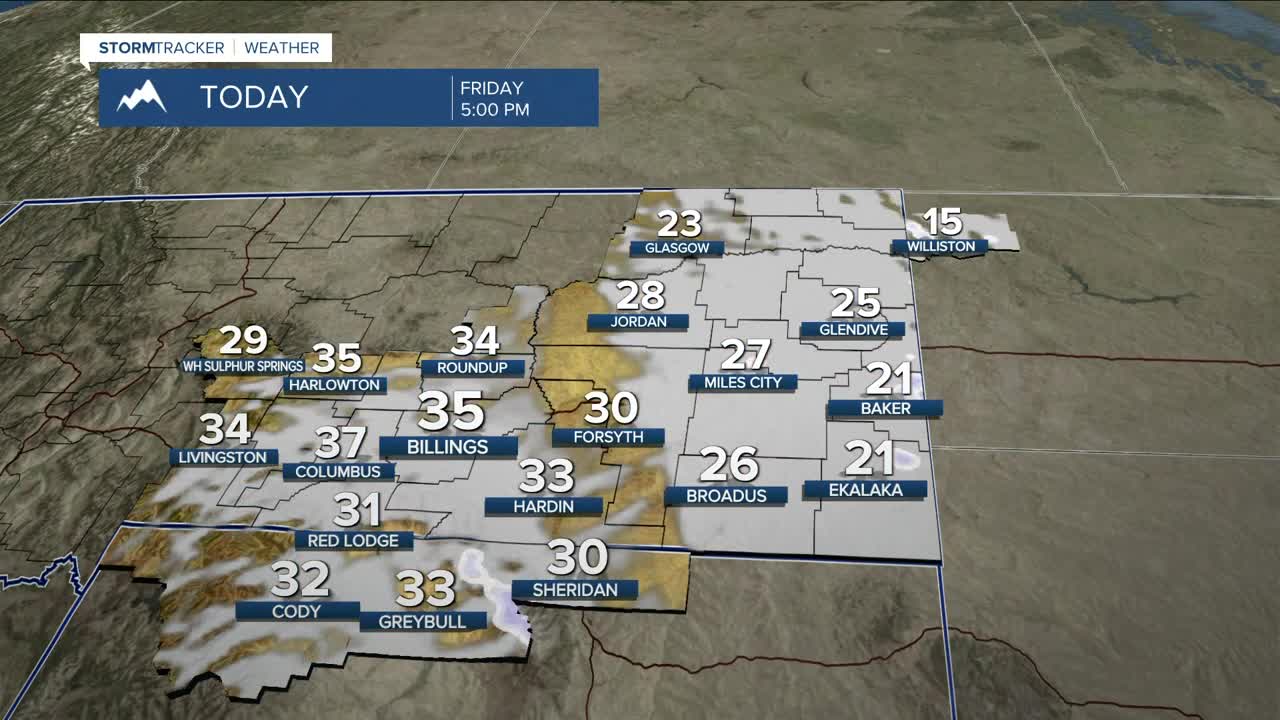
Friday will be the coldest day of the early year so far, with highs mainly in the 20s and 30s. Friday night into Saturday morning will be especially cold across eastern areas, where temperatures will drop into the single digits above and below zero. Combined with persistent winds around 30 mph, wind chills will fall into the negative teens and twenties, particularly across Carter and Fallon Counties.
Another windy period is expected on Sunday as a weather system moves in from Canada into the Dakotas. The strongest winds are most likely near the Dakotas border and in Sheridan County, Wyoming, where there is a moderate to high chance of gusts exceeding 50 mph. Elsewhere, winds will still be breezy to windy, with gusts generally in the 30 to 40 mph range.
Looking ahead to next week, temperatures will vary across the region. Western areas are more likely to see milder conditions with highs in the 30s and 40s, while eastern locations trend cooler with highs mainly in the 20s and 30s. There is some indication colder air could spread farther west late next week, but confidence is low at this time. Overall, dry weather is expected through the next seven days.
Miller Robson
Q2 Morning Meteorologist
miller.robson@ktvq.com
