


BILLINGS — A stubborn weather system puts our weather on hold. While areas near Billings and especially to the west will be breezy and once again have temperatures 15-20 degrees above normal by this weekend, eastern Montana will be cooler with a few possible showers.
A powerful low-pressure system over western Ontario and Hudson Bay is directing cold air over the eastern parts of the state while allowing warmer air to flood the west. This creates a temperature tug-of-war that will create a tighter pressure gradient.
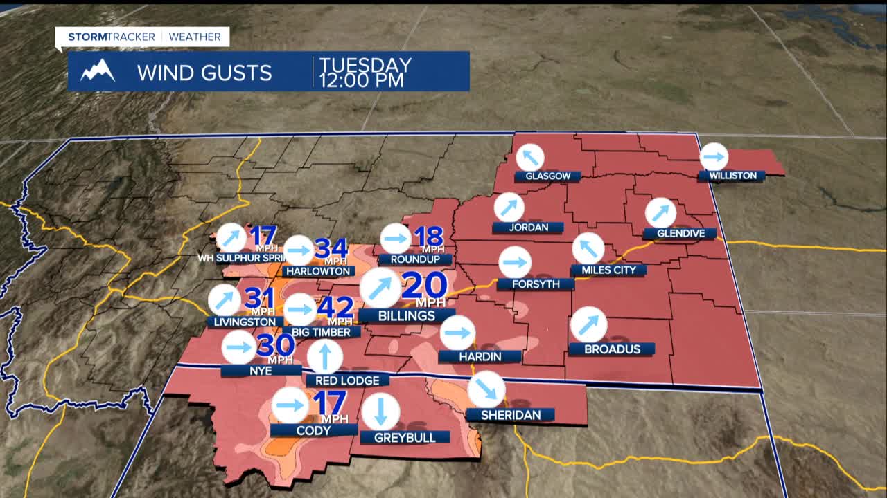
Areas west of Billings will experience "downsloping" where air tumbles down the mountains resulting in 20- to 40 mph gusts from Billings westward and warms us significantly. This process, combined with dropping humidity levels that could hit the teens, raises early concerns about fire weather conditions by week's end.
Eastern Montana won't be completely left out of winter's grip. Light snow remains possible as early as Wednesday, as small disturbances spin off the main weather system. Mountain areas should also prepare for occasional snow showers as these systems brush through.
