


BILLINGS — A cold front pushing through will increase winds across the area on Tuesday, with widespread gusts of 30–40+ mph expected. In addition to the wind, the passing shortwave will bring a period of snow showers, mainly in areas east and southeast of Billings, although Billings could see a flurry or two.
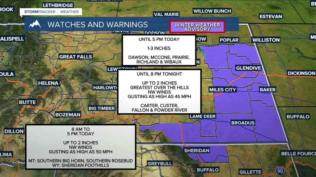
Given the combination of gusty winds, snow, and near- to slightly-below-freezing temperatures, a Winter Weather Advisory has been issued for Custer, Fallon, Carter, Powder River, Southern Rosebud, Southern Big Horn, and the Sheridan Foothills, where a few inches could fall. The primary concern is travel impacts, particularly over US-212 at Lame Deer and Home Creek Divides, and I-90 through Aberdeen Hill and Sheridan.
Winds diminish Tuesday evening, but another cold front pushing in by early Wednesday will bring another round of strong winds, with widespread gusts of 30–40+ mph. Gusts up to 60 mph will be possible in Fallon and Carter Counties and along the east side of the Bighorns. This system looks to be drier, but some light snow is still possible in our far eastern zones.
It will be turning colder, with highs in the single digits east to teens and 20s west by Friday, with overnight lows below zero east and single digits west. Some of our eastern towns could dip to -20°F Friday morning. Light snow is possible Thursday and Friday.
Heading into the weekend, a warming trend is forecast to slowly begin, with highs climbing into the 30s and 40s by Sunday and into early next week as gusty foothills winds return.
Miller Robson
Q2 Morning Meteorologist
miller.robson@ktvq.com
