


BILLINGS — Strong winds continue across most foothill areas Tuesday morning, with gusts between 50–60 mph possible. Winds will ease up for a few hours, then increase again with periods of strong gusts Tuesday evening through the rest of the workweek, with potentially dangerous crosswinds Wednesday through Friday. Winds will turn strong across the plains Wednesday into Thursday, with gusts over 50 mph possible in western and central areas as well as northern Wyoming.
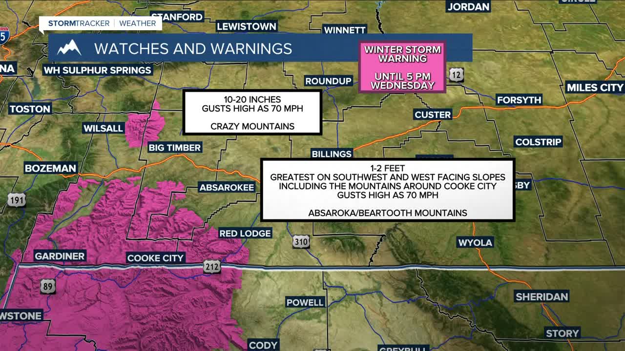
A cold front will bring periods of mountain snow and lower-elevation rain or a rain/snow mix through early Wednesday. The first push of moisture comes Tuesday, followed by a second push Tuesday into Wednesday morning. The Beartooths, Absarokas, and Crazies have a good chance of receiving 1–2 feet of snowfall. The Pryors and Bighorns could get well over 6 inches.
While rain is mostly expected in the lower elevations, some locations could get light snow of less than an inch, while higher hills could pick up 1–2 inches. Red Lodge could also get 1–2 inches, while Cooke City could receive over a foot.
Some models are suggesting a clipper will move through Friday into Saturday that will bring a chance for more snow and rain, along with colder temperatures.
Miller Robson
Q2 Morning Meteorologist
miller.robson@ktvq.com
