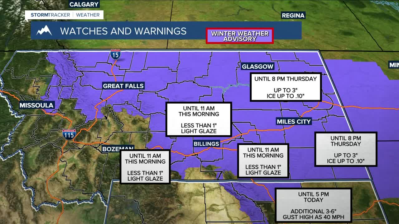


BILLINGS — A Winter Weather Advisory is in effect Wednesday morning as we wake up to snow (and possibly some ice) that will transition to rain in the afternoon as temperatures stay warmer than average. Highs will be in the 40s and 50s, but only in the 30s in our far eastern counties. Temperatures will be basically the same on Thursday.
As precipitation shifts east, strong downslope winds will return to the western foothills. Gap gusts could reach 70 mph tonight, with the US-191 corridor seeing up to 65 mph. The High Wind Watch has been upgraded to a Warning for Big Timber → Harlowton → Judith Gap, while the Wind Advisory remains in effect for Livingston and Nye. Winds are expected to persist through Thursday afternoon.
Rain and snow remain in the forecast for Thursday before a strong backdoor cold front sweeps through beginning Thursday evening, causing temperatures to drop rapidly—upper 50s at 3 p.m. could fall to upper 20s by 6 p.m., with teens overnight. Flash-freeze risk is high, making the Thursday evening commute potentially hazardous.
Snowfall from Thursday night through Saturday morning is expected to be weaker than previous forecasts. The heaviest snow will fall east of the foothills, with 4–10" possible from Harlowton → Billings → Crow Agency → Miles City/Broadus. Western foothills will see brief snow with the front. A Winter Storm Watch will be in effect.
Colder-than-normal temperatures (teens and 20s) are expected Friday and Saturday, though western foothills may vary. Elevations above ~6,000 ft will largely escape the cold, but upslope flow will produce additional mountain snowfall.
Pacific flow and above-normal heights will dominate Sunday into next week, bringing a quick return to above-normal temperatures and mainly dry conditions.
Miller Robson
Q2 Morning Meteorologist
miller.robson@ktvq.com
