


BILLINGS — After a cold weekend, a large ridge anchored over the west coast has our region under anti-cyclonic NW flow. The net result is short term wind, especially in the foothills and Paradise Valley, and warming in the long term.
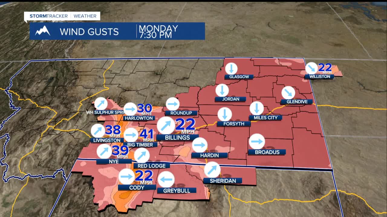
Strong wind gusts 50 to 70 mph will continue in our gap areas around Livingston, Nye, Harlowton and Big Timber. Blowing snow may still produce icy patches. Winds will back off late today, especially from Big Timber to Harlowton along US-191 with gusts of 25 to 40 mph into Tuesday around Livington and Nye.
The latest analysis indicate a high pressure aloft prevailing the rest of the week bringing warmer-than-average temperatures once again. There may be some minor disturbances that bring us some isolated mountain snow showers, but nothing substantial.
Colder air may impact areas by the eastern state line later in the work week producing some flurries or light snow, but the dominant downslope wind pattern will keep dry and much warmer conditions in place. So look for moderating temps today ranging from near 40 west to lower 20s along the Dakota borders...and by midweek about 10 degrees warmer with highs near 50 west to near 30 east.
By the weekend we may see mid 50s west to lower 40s east. Billings even has a 50% chance of seeing 60 degrees somewhere in the area next weekend. Due to dry and abnormally mild conditions we will need to monitor rangeland fire conditions later in the week.
As is typical with this type of mild pattern, expect periods of breezy to gusty wind for the western foothills.
