


BILLINGS — Our rain and snow is ending with over an inch of rain reported at the Billings airport this weekend. Another round of rain and mountain snow is possible this coming weekend.
Snow levels will fluctuate around 4,500-5,000 feet Sunday evening, with wet snow in foothills and accumulating snow above 6,000 feet. With lower elevation rain and higher elevation snow tapering off tonight, a clearing sky will lead to cold Monday morning temperatures.
There is a high probability of frost or freeze for most areas tonight through Monday morning. That may hold back afternoon highs despite a sunny day.
With a clearing sky by Monday morning, the western foothills dropping into the 20s° and the eastern plain and northern Wyoming will be in the mid-20s to mid-30s. That will bring the potential for slick spots on foothill roads as temperatures cool.
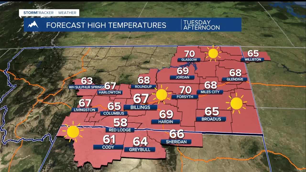
Monday-Friday: Dry and increasingly warmer conditions under high pressure. That will bring a clear sky and afternoon temperatures rising from 50s on Monday to 60s-70s by Wednesday-Saturday.
Next Weekend: Increasing chance of precipitation (20-50% depending on location).
