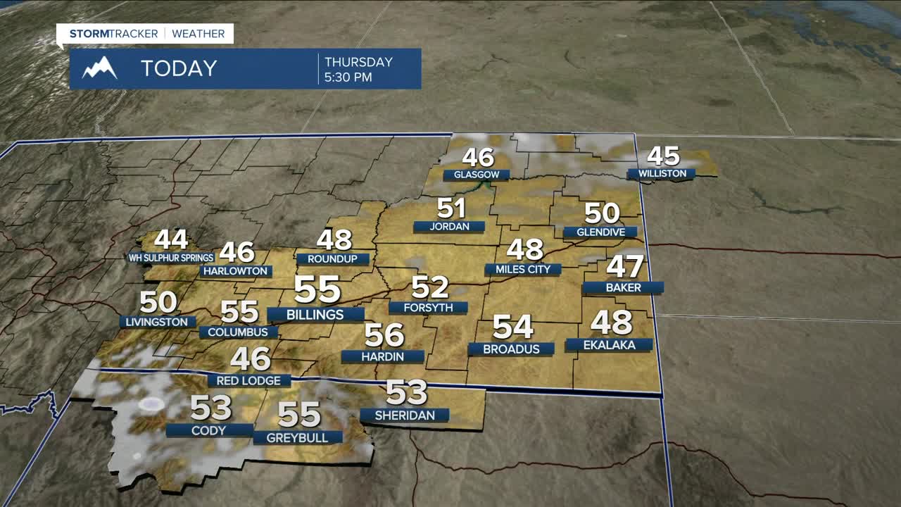


BILLINGS — We can expect mainly dry conditions and warmer-than-average temperatures through Monday, with highs ranging about 10–15 degrees above normal, in the mid-40s to mid-50s. Skies should be sunny to mostly sunny Thursday and Friday, with more clouds mixing in Saturday and Sunday.
Some models show a weak disturbance moving through Saturday night into Sunday that could bring just enough moisture for a chance of snow in higher elevations, with only light accumulation expected.
Winds are expected to increase across the western foothills Saturday through the middle of next week as the pressure gradient tightens, with gusts up to 50 mph (possibly stronger), especially from Livingston to Nye.
Models are starting to gain confidence in a change to a cooler and wetter pattern by the middle of next week, with persistent troughing in the West. Will this mean snow in the lower elevations? It’s way too early to say for sure at this point. Stay tuned.
Miller Robson
Q2 Morning Meteorologist
miller.robson@ktvq.com
