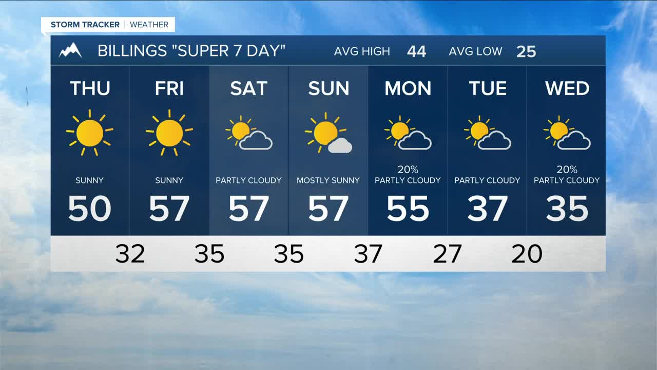


BILLINGS — Broad, dry zonal flow is settling in and will keep conditions dry across the region Thursday through Sunday. Expect plenty of sunshine through Friday, then clouds from time to time over the weekend. Daytime highs will range from the upper 40s to upper 50s and even some lower 60s on Sunday.
Breezy foothill winds kick in Friday evening with 20–35 mph gusts possible, then a stronger round of pre-frontal winds is forecast to arrive Sunday night into Monday, bringing gusts over 50 mph from Livingston to Big Timber and up toward Harlowton during that period.
Confidence is very high that a cold front will drop down from Canada and bring the coldest air of the season so far starting Tuesday, with highs in the 30s and lows in the teens and 20s. Snowfall remains uncertain. Models suggest only light accumulations Tuesday and Wednesday, with a better chance for 1–3 inches west of Yellowstone County Wednesday night into Thanksgiving Day. Any wintry weather next week could impact Thanksgiving travel, so plan accordingly, be prepared, and continue to monitor the forecast if you’ll be on the road.
Miller Robson
Q2 Morning Meteorologist
miller.robson@ktvq.com
