


BILLINGS — SUNDAY NIGHT THROUGH TUESDAY: An active weather week kicks off tonight with strong winds hitting the western foothills. Livingston and Nye are in for a rough ride with gusty crosswinds starting Sunday night and lasting through Tuesday morning, with gusts reaching up to 60 mph during the strongest period Monday night into Tuesday morning.
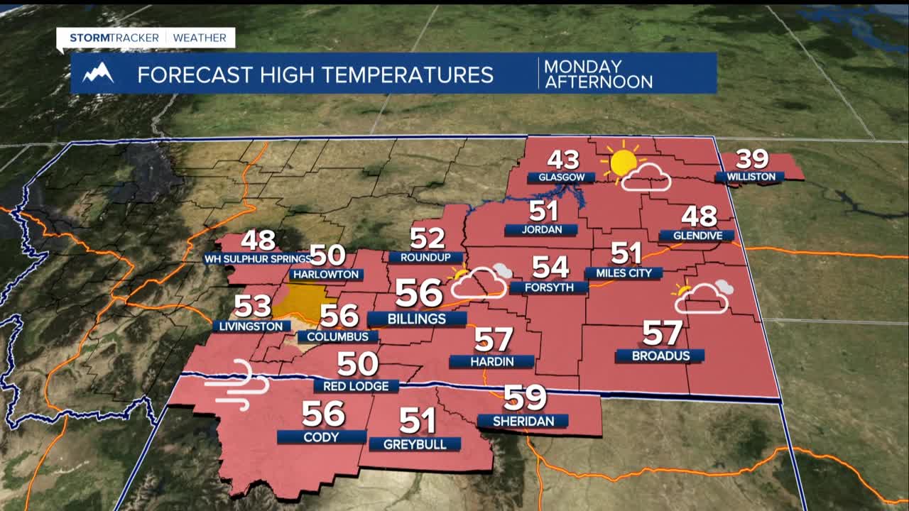
Big Timber and the Melville foothills are under a High Wind Watch from 11 AM Monday until 5 AM Tuesday. While there's some question, gusts could still reach 40-50 mph. Temperatures will be mild Mnday afternoon with highs in the 40s and 50s.
TUESDAY NIGHT: Heavy snow will fall in the Beartooth-Absaroka Mountains, with 10-20 inches expected through Wednesday afternoon. Lower elevations will see a messy mix of rain and snow. While the gap locations get a brief break from the strongest winds, gusty conditions continue through much of the week.
WEDNESDAY: Wednesday morning brings a more powerful weather system crashing through the area. This is when things get more dangerous for a wider area. The US-191 corridor from Big Timber through Harlowton faces wind gusts climbing into the 50s and 60s mph.
Across the plains, expect gusts reaching 30-40 mph, with some areas west of Billings potentially seeing gusts up to 50 mph on higher hills. More rain and snow showers accompany this system.
THURSDAY-FRIDAY: Big Timber through Harlowton could see gusts in the 60s mph and strong enough to create hazardous driving conditions, especially for high-profile vehicles. The mountain snow continues with blowing and drifting creating additional hazards and increased avalanche danger.
SATURDAY-SUNDAY: The forecast carries high uncertainty toward the weekend, with the potential for much colder air and possibly another Arctic front arriving.
Safety note: With weak winter conditions and an extended dry spell, anyone heading into avalanche terrain should check mtavalanche.com before venturing out. Stay weather-aware and monitor updates throughout this active week.
