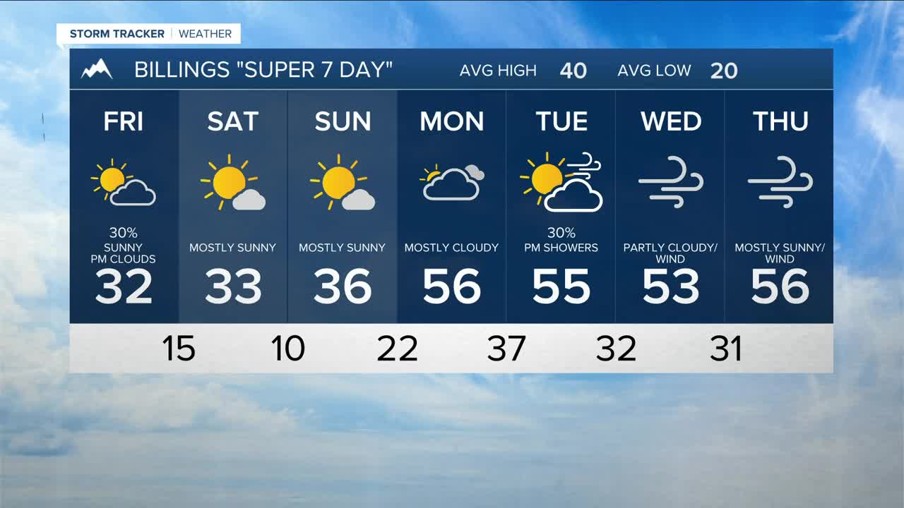


BILLINGS — There is a chance of fog Friday morning, especially in river valley areas. Watch out for reduced visibility while driving. Roads are also still slick around the area. It will be very cold, with wind chills as low as double digits below zero in some locations. Make sure kids are layered up for school!
We may not be completely done with snow yet, as a weak disturbance is expected to move through Friday into Saturday, bringing the best chance of 1–3 inches to the west-northwest slopes of the Beartooths and Crazies. Lower elevations may see some light snow showers, with little to no accumulation (less than 1 inch) expected.
After enduring a few very cold days, temperatures will now gradually warm moving forward as high pressure brings dry conditions. Daytime highs will be mainly in the 20s and 30s Friday through Sunday before warming into the 40s and 50s early next week.
By the end of the weekend and into early next week, gap winds will be on the increase across the western foothills again, with gusts in excess of 50 mph possible, especially from Livingston to Nye. Gusts over 30 mph will be possible elsewhere.
A blend of models is forecasting a return to a more unsettled weather pattern by the middle of next week, if not sooner, which could bring more precipitation to the region.
Miller Robson
Q2 Morning Meteorologist
miller.robson@ktvq.com
