


BILLINGS — Monday will be dry and warmer, with highs near the mid-50s in many areas. It will also be very windy, with southwest gusts between 55-65 mph from Livingston to Nye through late Tuesday morning (Wind Advisory). Gusts of 50-60 mph expected from Big Timber to Harlowton (High Wind Watch) Monday afternoon through Tuesday morning. Winds remain gusty across the foothills, and breezy to gusty conditions will persist elsewhere, with winds between 20-30 mph, especially in the far east, but dangerous crosswinds could develop Wednesday through Friday.
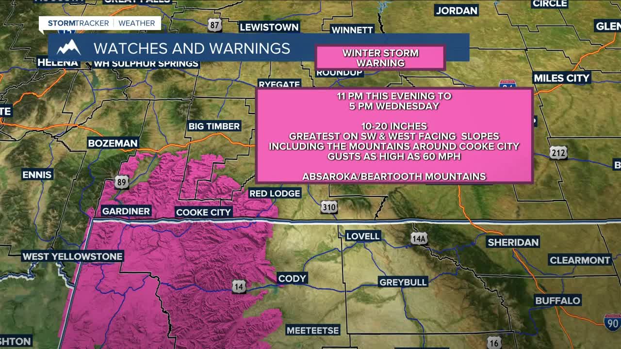
A shortwave will bring a chance of snow to the south and west of the Absarokas and Beartooths Monday night into Tuesday, with a rain/snow mix possible in lower elevations. A stronger system is forecast for Tuesday into Wednesday, bringing heavier snowfall to the mountains. A Winter Storm Warning will be in effect from 11 PM Monday until 5 PM Wednesday, with 10-20 inches possible, especially on southwest and west-facing slopes and around Cooke City. Winds could gust up to 60 mph. Lower elevations may see up to a quarter of an inch of rain/snow.
Cooler air behind the system will keep highs in the 40s and 50s for the rest of the week, with drier conditions. However, some models suggest another wave of colder, arctic air could bring more rain and snow for the weekend.
Miller Robson
Q2 Morning Meteorologist
miller.robson@ktvq.com
