


BILLINGS — Through Sunday, unseasonably warm temperatures will continue with temperatures 10 to 15 degrees above normal. Highs will be reaching the mid-50s to low 60s.
Dry conditions continue for now. But there will be some wind. Breezy to gusty winds in western foothills will reach 25-40 mph Friday and off and on over the weekend.
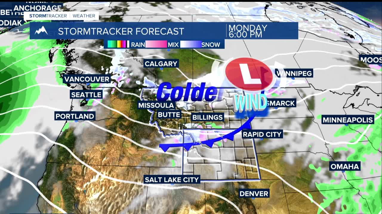
Monday will be our transition day. Two weather fronts move through the area. Temperatures drop to the 40s with light rain/snow, especially near the mountains. Gusty winds of 30-40 mph are possible as the fronts move through. Snow levels drop to around 3,000 feet by evening, meaning even the lower elevations could see at least some flurries.
For Tuesday through Thanksgiving Day, things turn much colder with highs mainly in the 30s with lows in the teens to low 20s. There is potential for light snow, though amounts remain uncertain.
Once we get closer to Thanksgiving, the weather models show conflicting scenarios. Some predict significant snow and strong winds that could impact travel east of Billings, while others show lighter snow but bitter cold temperatures.
If you're planning holiday travel next week, especially heading east, keep a close eye on the forecast. The biggest travel impacts may actually come the weekend after Thanksgiving rather than before it.
