


BILLINGS — Christmas week is bringing a mixed bag of weather to eastern Montana and northern Wyoming, with continued mountain snowfall but warmer-than-normal temperatures for most areas.
Snow will keep falling in the Absaroka/Beartooth Mountains through Tuesday morning, though additional accumulations should remain less than 6 inches.
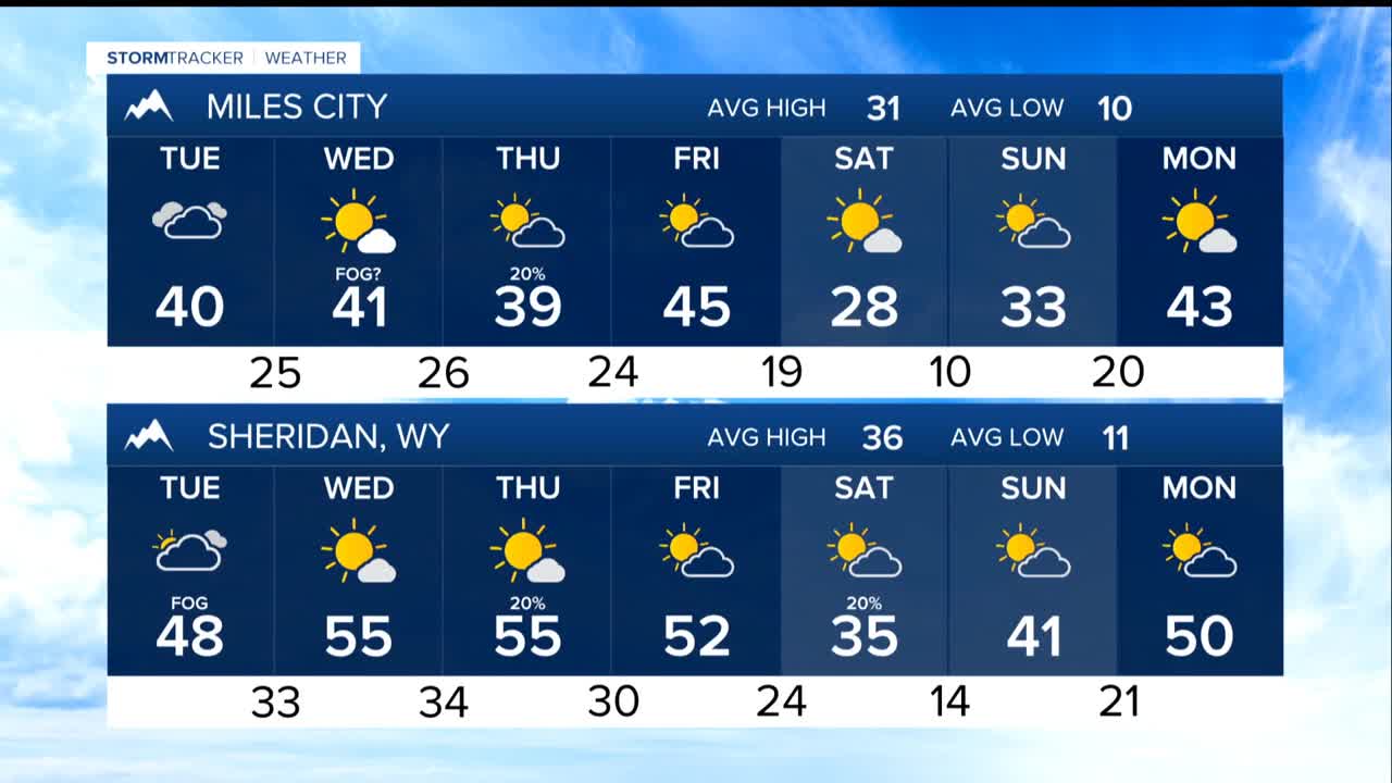
The bigger weather story this week is the warmth. Temperatures will climb into the 40s and low 50s Tuesday and Wednesday. That is well above average for late December. By Wednesday, some areas could see temperatures in the mid-50s.
A weak weather front moving through early Christmas Day will cool things down slightly, bringing temperatures back to the 40s and low 50s. This front also brings a 20-40% chance of light rain or snow, mainly west of Rosebud County. However, any precipitation is expected to be light, with most areas seeing less than a tenth of an inch.
The mountains will see more action later in the week. Thursday through Saturday, a weather pattern will set up that favors continued light to moderate snowfall in the Beartooth and Absaroka ranges. Mountains north of Cooke City have about a 70% chance of receiving 6 or more inches of snow during this period.
Saturday will bring cooler, more seasonal temperatures back to the region, with highs in the 30s and a small chance for light precipitation. Temperatures will rebound into the 40s again by Sunday.
Overall, no major storms are expected through the holiday week, making travel conditions generally favorable despite the ongoing mountain snow.
