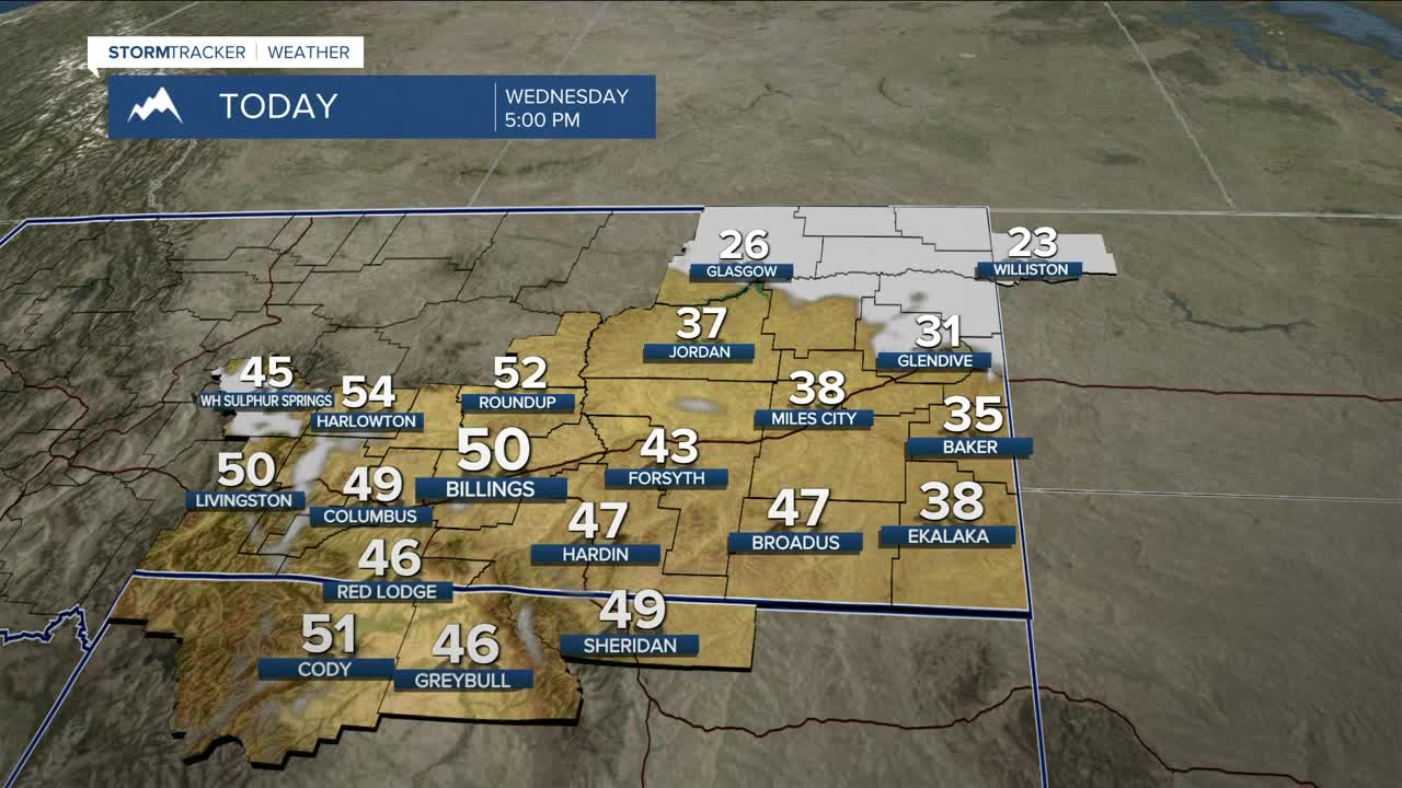


BILLINGS — The region remains stuck between a strong ridge to the west and a deep trough over the eastern U.S., keeping the area under the influence of northwest flow. That means mainly dry and warmer-than-average conditions will stay put through at least the first half of next week. Billings could flirt with a record high on Wednesday (53° in 1980).
A backdoor cold front dropping down from Canada on Wednesday will cool temperatures slightly through the end of the workweek in our eastern counties. A few morning snow flurries could also pop up.
Foothills winds remain the bigger story. Gusts in the 40–50+ mph range will continue Wednesday morning around Livingston, Nye, Big Timber, and Harlowton, then ease later in the day as the pressure gradient relaxes. Winds ramp back up Wednesday night into Thursday morning. Friday and Saturday look calmer, with gusts mainly in the 15–30 mph range, before stronger winds return Saturday night into early next week, when gusts could top 50 mph.
Meanwhile, increasing mid-level moisture will bring periodic light snow chances to the southwest mountains starting Friday and lasting into early next week, with light accumulations expected—maybe a few inches.
Miller Robson
Q2 Morning Meteorologist
miller.robson@ktvq.com
