


BILLINGS — TODAY THROUGH TONIGHT: Today brought more of our unseasonably warm stretch, with most areas climbing into the 60s. A cold front will arrive out of the west late tonight. Wind gusts through the foothill gaps area along I-90 should generally stay in the 30–40 mph range through tonight's frontal passage.
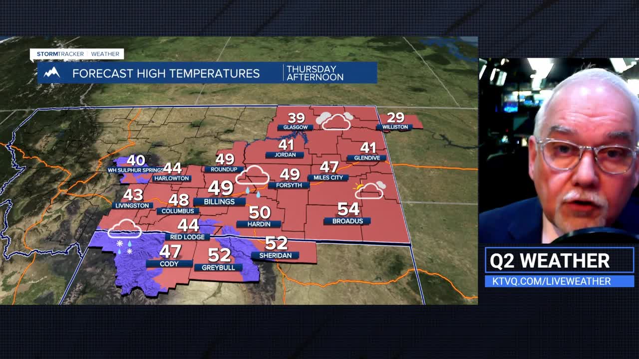
THURSDAY THROUGH FRIDAY: The arriving cold front brings cooler temps maxing out in the 40s to lower 50s, with rain at lower elevations and accumulating snow in the mountains and foothills. High confidence here.
In the mountains, northwest and north-facing aspects will see a solid 6 to 12 inches of snowfall between late tonight and Friday. The higher peaks of the Absarokas south of Livingston could see local totals of 12 to 15 inches.
By Thursday night, snow levels will drop for most locations as a push of Canadian cold air filters in. If the upper-level trough holds over the region into Friday morning, wet snow accumulation become heavier along the north-facing foothills. Red Lodge, Story, and Pryor have 1 to 4 inches expected and a 40% chance of more than 4 inches.
A secondary, weaker shortwave in the unstable northwest flow Friday could further enhance snow shower chances. There's also a 20% shot at 1 to 2 inches of wet snow over higher terrain near Columbus, Billings, Lame Deer, and Sheridan.
Travel impacts are possible on I-90 and US-212 into Friday morning, and a Winter Weather Advisory has been issued for the Pryors and Bighorns. US-14 through Burgess Junction will see impacts. Rainfall totals will be modest but welcome: 0.10–0.30" at lower elevations west of Rosebud (Forsyth) County (including Billings and Yellowstone County), and 0.50–0.80" over the mountains.
THE WEEKEND: Once the trough clears out Friday, the downslope gradient tightens, and the winds fire up. Livingston to Big Timber and Harlowton face a 70–80% chance of gusts reaching 60 mph. By Sunday into early Monday, a pre-frontal push could send gusts to 70 mph.
Alongside the wind comes a surge back into the upper 50s and 60s and relative humidity potentially dropping to 20% or lower. That raises elevated grass fire concerns, particularly if we don't get as much precipitation as forecast.
NEXT WEEK: The ridge breaks down sometime Monday, and with it comes another round of cooler temperatures and increasing precipitation chances through the first half of next week. A broad trough is expected to set up over the northern Rockies, pushing heights well below normal. Mountain snow accumulation returns, and lower elevation snowfall is possible again as cold Canadian air pushes south.
