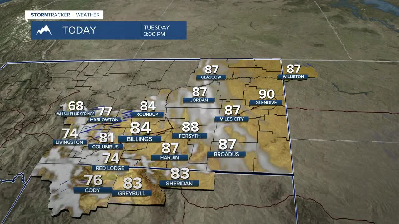


BILLINGS — While most of the area will stay dry on Tuesday, southwest flow will keep a decent chance of light showers in the forecast through Wednesday, mainly over the mountains and foothills. Billings may get a shower this evening or overnight. Highs will stay 10–20° above average through Wednesday.
A Pacific trough will begin to influence the region on Thursday, shifting the area into a cooler and wetter weather pattern through the weekend and into early next week. Daily rain showers will be possible during that stretch, with only light accumulation expected.
Daytime highs will remain above normal on Thursday, but will cool to the mid-70s to low-80s. Cooler air will really begin to settle in on Friday and Saturday, with highs mainly in the low to mid-60s. A cold wave is expected to drop down from Canada late Saturday, knocking daytime highs down mainly into the low to mid-50s on Sunday and Monday.
Widespread mountain snow is likely from Thursday evening through early Saturday morning, with at least 3 inches of snow possible above 8,000 feet. Another push of moisture late Saturday could bring several more inches by Monday morning. Models still differ on this, so we'll have to wait to see how they evolve over the next few days.
Nighttime lows will be in the 40s and 50s through Thursday night, then cool to the 30s and 40s Friday night through early next week.
Miller Robson
Q2 Morning Meteorologist
miller.robson@ktvq.com
