


BILLINGS — A powerful weather pattern is setting up to bring an elevated fire risk across south-central Montana over the next several days. Temperatures will be in sight of daily record highs.
The trouble begins tonight along the western foothills, where strong wind gusts between 50 and 65 mph are expected to develop and continue through Monday. These are winds strong enough to knock down tree branches, make driving hazardous for high-profile vehicles, and potentially cause power outages.
What makes this situation particularly concerning is the combination of factors coming together. The region is experiencing unseasonably warm temperatures with low humidity levels and those powerful winds, you create a perfect recipe for grass fires to ignite and spread rapidly.
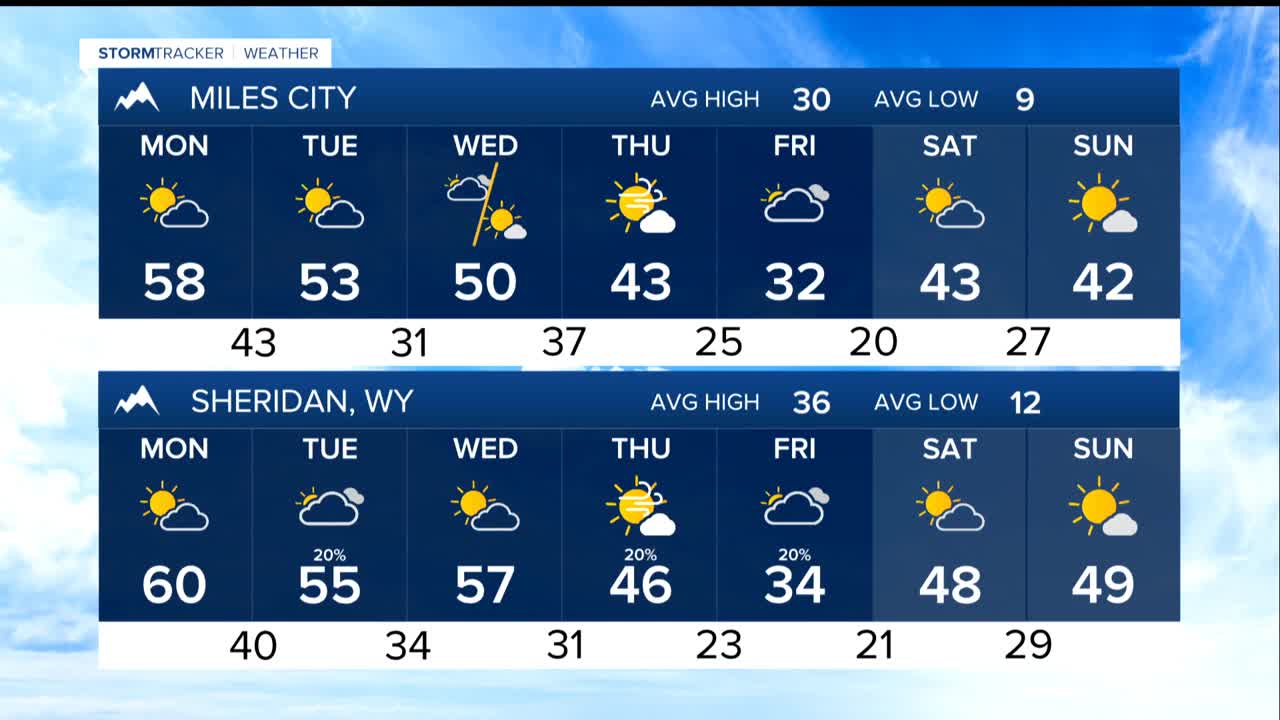
The National Weather Service has issued a Rangeland Fire Danger statement for the western half of the region, urging residents to be extra cautious about any activities that could spark a fire. With temperatures climbing to around 60°F Monday and remaining in the 55-65°F range through Wednesday, this fire concern isn't going away anytime soon.
Strong gusts will continue to buffet the foothills through Wednesday, with another round of 40-50 mph winds expected late Wednesday and Wednesday night as a Canadian weather system approaches.
Relief finally arrives Thursday and Friday as that Canadian front pushes through, bringing the first real break from the warm, dry pattern. Temperatures will drop significantly—from the current 50s and 60s down to the upper 20s and lower 40s by Friday. There's even a slight chance of rain and snow showers, though most areas will likely stay dry.
This is one of the warmest first halves of January on record for the region. While the weekend looks to bring drier and slightly warmer conditions again, genuinely colder air could return by the third week of January. Check back for updates as we get later in the week.
