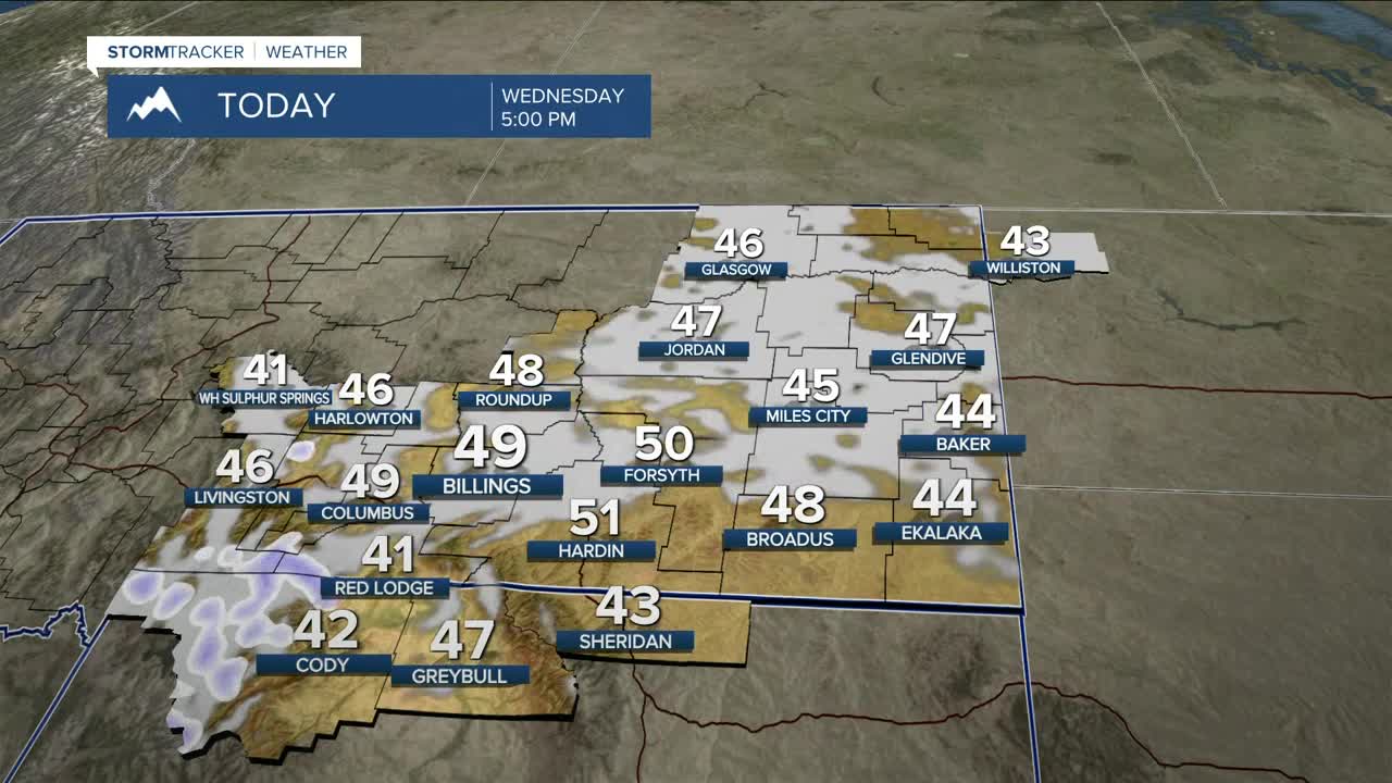


BILLINGS — Wednesday looks mostly quiet, but winds may start to increase by the afternoon across the western foothills, especially gap flow areas like Livingston and Nye. Winds could also gust between 30–40 mph by the afternoon in many other areas, which will help warm daytime highs into the upper 40s to low 50s.
High Wind Warnings and High Wind Watches will be in effect across the area as a robust jet streak really drives winds starting Wednesday night and into Thursday, with potential gusts between 65–90 mph in the western foothills and mountains, while gusts generally between 50–70 mph will be possible over the plains. Damage to rooftops, fences, and trees is very possible with these winds. Power lines will also be at risk. Grass fire risks are also possible, depending on what areas saw adequate moisture over the last few days. A cold front dropping down from the north will help ease winds down to the 25–35 mph range by early evening, then to under 20 mph as the evening progresses. Thursday's highs will be in the mid-50s to low 60s.
As the front makes its way through, some scattered rain/snow showers will develop Thursday evening, which could impact the Friday morning commute.
A warm and cold air boundary will slowly move north and northeast through Friday, bringing the potential for a few inches of wet snow along the boundary. The snow band is expected to move east as the day progresses, dropping snow on areas like Miles City and Baker. Highs on Friday will range from lower 50s west to mid-30s east.
Another weak wave is forecast to push colder air in starting Friday night that is expected to remain through the weekend, with highs in the 30s and 40s Saturday, then 20s and 30s Sunday.
Up next, Winter Storm Watches will be in effect for parts of the region as a steady stream of Pacific moisture (atmospheric river), along with warm air moving over a layer of colder air near the surface, will prime the engine for snowmaking Thursday through Sunday, with a chance of 1–3 feet of snow in the mountains and up to 4 inches (or more) over the lower areas. Garfield and Petroleum counties could get anywhere from 2–12 inches. That is a wide spread, as there is still uncertainty with totals and locations depending on how this system evolves, so be sure to monitor the latest forecasts.
In terms of total moisture, anywhere from .50 to 1.50 inches could accumulate, something we greatly need as we head into the spring and summer months and wildfire season.
After a colder weekend and a chilly start to next week, high pressure will gradually help daytime highs warm into the 60s and 70s for some locations by the middle of next week.
Miller Robson
Q2 Morning Meteorologist
miller.robson@ktvq.com
