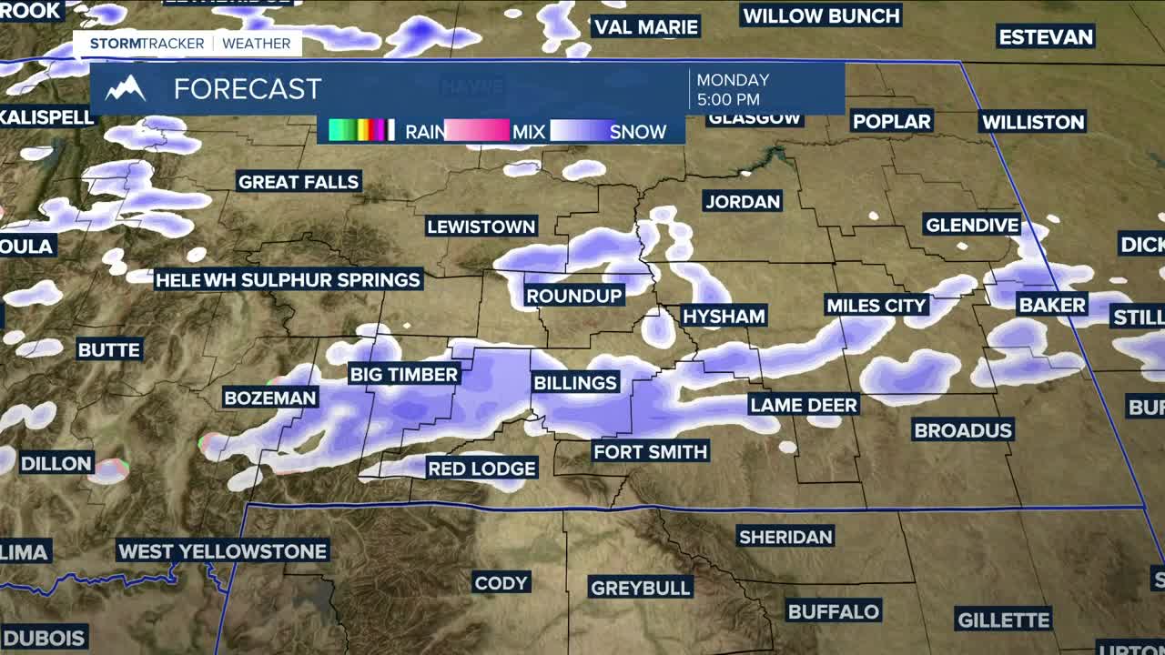


BILLINGS — A cold front (enforced by a secondary wave) will bring a chance of precipitation Monday into Tuesday. 4-8 inches of snow across the mountains, 1-2 inches in the Red Lodge Foothills, 1-3 inches in the Sheridan foothills (Winter Weather Advisory Tuesday afternoon through Wednesday morning), and light snow or rain/snow in the lower elevations will be possible. Between .10 and .25 inches of total moisture is possible in central and western counties in the Q2 viewing area.
The cold front will also cool daytime highs down mainly into the 30s and 40s Monday and Tuesday.
High pressure will briefly bring mainly dry conditions on Wednesday, along with warmer daytime highs in the 40s and 50s.
Highs will reach into the 50s and 60s on Thursday as strong wind gusts over 60 mph return to much of the region ahead of another potential cold front that could bring more rain, snow, and cooler temperatures Thursday night through the weekend. There is still some uncertainty with this, though.
Miller Robson
Q2 Morning Meteorologist
miller.robson@ktvq.com
