


BILLINGS — A backdoor Canadian cold front will be sweeping through the area Wednesday morning, bringing gusty northwest winds up to 60 mph from Billings and especially eastern Montana down to northern Wyoming where blowing snow could reduce visibility during the morning commute. Daytime highs will be in the 20s east to 30s west as colder air begins to pour in.
That frigid air will really start to move in Wednesday night, knocking overnight lows down into the single digits east to teens elsewhere.
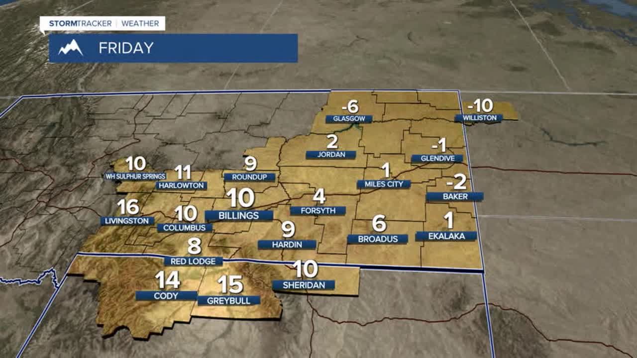
Strong high pressure over the northern high plains Thursday into Friday will help really cool things down, ushering in the coldest air of the year so far. Highs on Thursday will range from the single digits east to 20s west. Wind chills could dip to 30 below in eastern Montana by Thursday evening and actual temperatures could reach 20 below as early Friday morning and Saturday morning, too.
Conditions are expected to be mostly dry Thursday and Friday, but some light snow is possible late Thursday into Friday. Billings could pick up some light accumulation with some models hinting at 1-2".
Another Canadian cold front is forecast to move through sometime this weekend (timing is still a bit up in the air), keeping temperatures on the cold side Saturday and Sunday along with the potential for more light snow. Highs will be in teens and 20s on Saturday then 20s and 30s on Sunday before pushing into the 30s and 40s early next week.
Miller Robson
Q2 Morning Meteorologist
miller.robson@ktvq.com
