


BILLINGS — We’re already seeing strong, gusty winds Monday morning, especially along the western foothills and nearby areas like Livingston, Big Timber, Nye, and Harlowton. Some spots have seen gusts around 40–50 mph, and while winds ease a bit this afternoon, they may pick back up tonight before calming down again Tuesday. A few isolated stronger gusts can’t be ruled out, but widespread wind issues aren’t expected. With lighter, powdery snow on the ground, there could be some patchy blowing and drifting snow this morning into early afternoon. Impacts should stay minor, but brief reduced visibility is possible in spots.
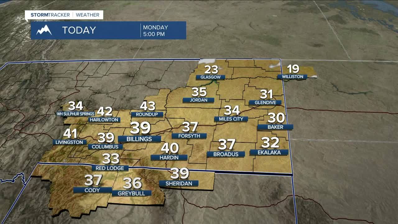
Temperatures are on the way up Monday, reaching the lower 40s west, with southeast Montana hovering closer to freezing. It gets even warmer Tuesday, with highs climbing into the mid to upper 40s west and upper 30s east, while winds gradually settle down during the afternoon.
A backdoor cold front slides into eastern Montana Wednesday and could knock temperatures down a bit, especially north and east of Billings, but precipitation looks unlikely. Temperatures may also fluctuate more than usual midweek.
Looking toward late week and the weekend, most lower elevations stay mild, mostly dry, and breezy at times, with highs generally in the 40s to low 50s. The mountains, however, will see periods of snow, mainly on west-facing slopes, which will help add some much-needed snowpack. Snow levels stay high, so valley locations should remain dry despite more clouds.
Miller Robson
Q2 Morning Meteorologist
miller.robson@ktvq.com
