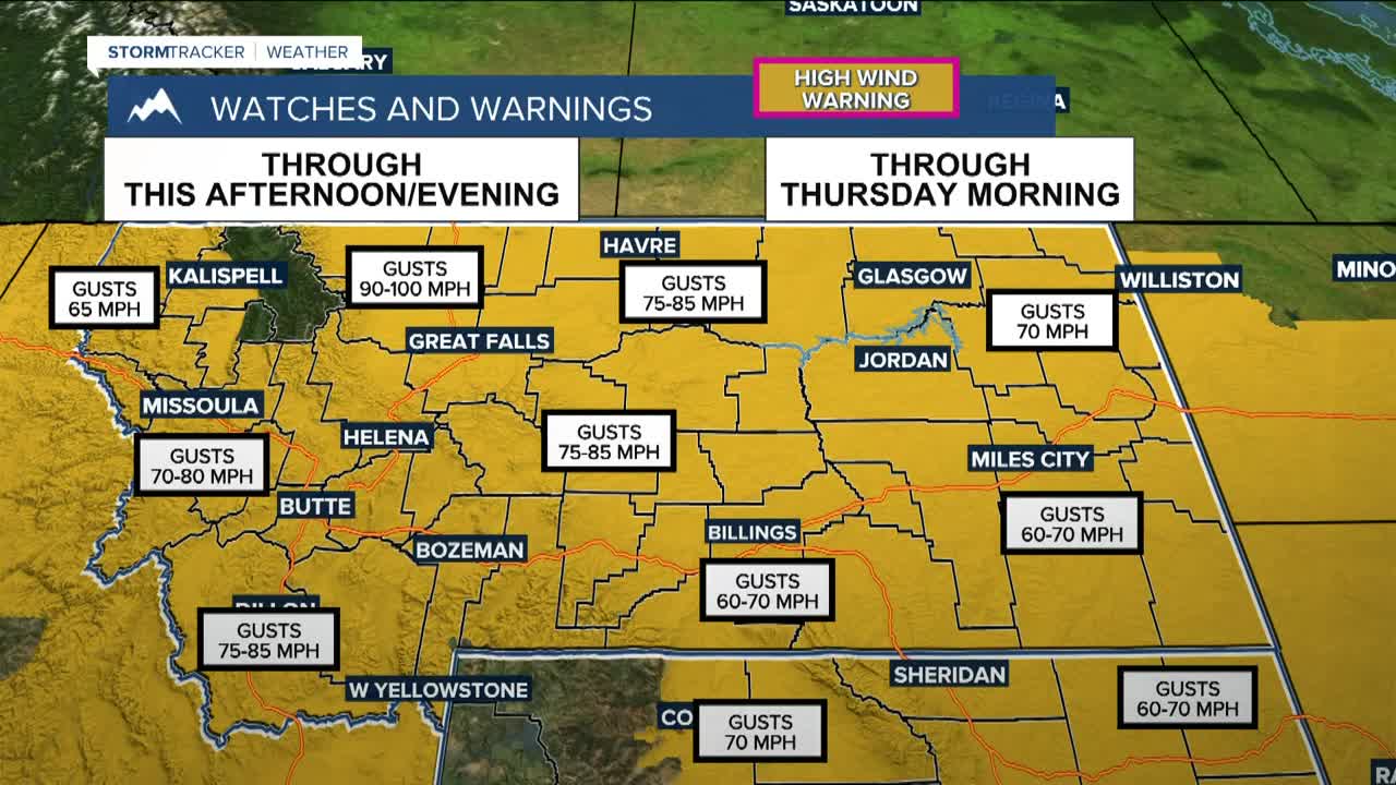


BILLINGS — Strong, widespread winds are the big weather story on Wednesday. High Wind Warnings are in effect across the region, and winds will ramp up quickly around midday. Gusts of 60 to 70 mph will be common at lower elevations, with the strongest winds capable of knocking down trees, damaging power lines, and impacting some structures. Gusts up to 80 mph will be possible in our western mountains. Travel and outdoor activities will be affected, so secure loose items and plan ahead. Red Lodge Mountain is closed due to the strong winds.
As a cold front moves through Wednesday, strong winds will spread east from the foothills across much of the area. Rather than calming down this evening, winds are expected to remain strong or even increase tonight, especially across central and eastern areas, with gusty conditions possibly lingering into Thursday morning near the Dakota border.
Along with the wind, rain and snow showers will move through with the cold front. As temperatures fall into the teens and 20s tonight, parts of far southeast Montana could see reduced visibility from blowing snow, while western areas stay milder.
Snow continues in the western mountains through this evening, with 5 to 10 inches expected on west-facing slopes. Thursday turns cooler, with highs mainly in the 20s across the east and lower 40s in the west. Winds may briefly ease before another round of strong foothill winds Thursday night into Friday, especially from Livingston to Nye and along the Highway 191 corridor.
Looking toward the end of the week, another surge of Pacific moisture arrives late Thursday into Saturday, bringing several rounds of heavy mountain snow. There is a 90% chance of at least a foot of snow in the Beartooth and Absaroka Mountains, and a Winter Storm Watch is in effect for those areas from Thursday afternoon through Friday night. Some lower elevations and foothills could also see light accumulating snow Friday night into Saturday morning.
Into the weekend and early next week, the pattern stays active at times with occasional mountain snow. Temperatures remain above average, with highs generally in the 30s to near 50 degrees, coolest across eastern areas.
Miller Robson
Q2 Morning Meteorologist
miller.robson@ktvq.com
