


BILLINGS — More snow across northern Montana, and wind in the Livingston area highlights Tuesday's and Wednesday's weather. Then it gets a little quieter but stay chilly for a while.
In the Livingston to Big Timber area, along Interstate 90, winds gust 40 to 50 mph Monday evening through Tuesday morning. With recent snow of 6 inches or more in this area, blowing snow may drastically reduce visibility. Slow down, and be aware of quickly changing conditions.
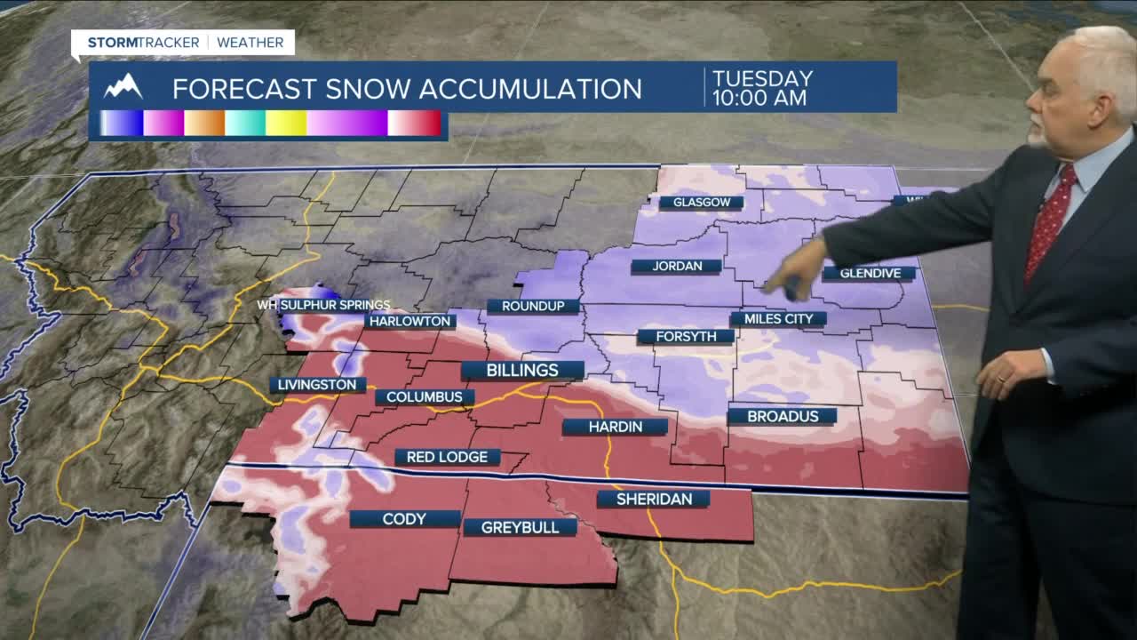
For areas north of Billings, another round of snow develops Monday night and continues into Tuesday evening. In a narrow band from Roundup eastward to Baker, and several new inches of snow are possible. The heaviest snow is expected Tuesday evening.
Temperatures will likely fall over much of the area Tuesday, reaching the highs early in the day. Expect most reading in the teens by the afternoon except in the wind-prone areas mentioned above. Single digits to low teens are expected early Wednesday.
For the rest of the week, most of Southern Montana will have highs in the mid-20s to mid-30s and low mainly in the teens. Other than some mountain snow, things will be dry until perhaps the weekend.
