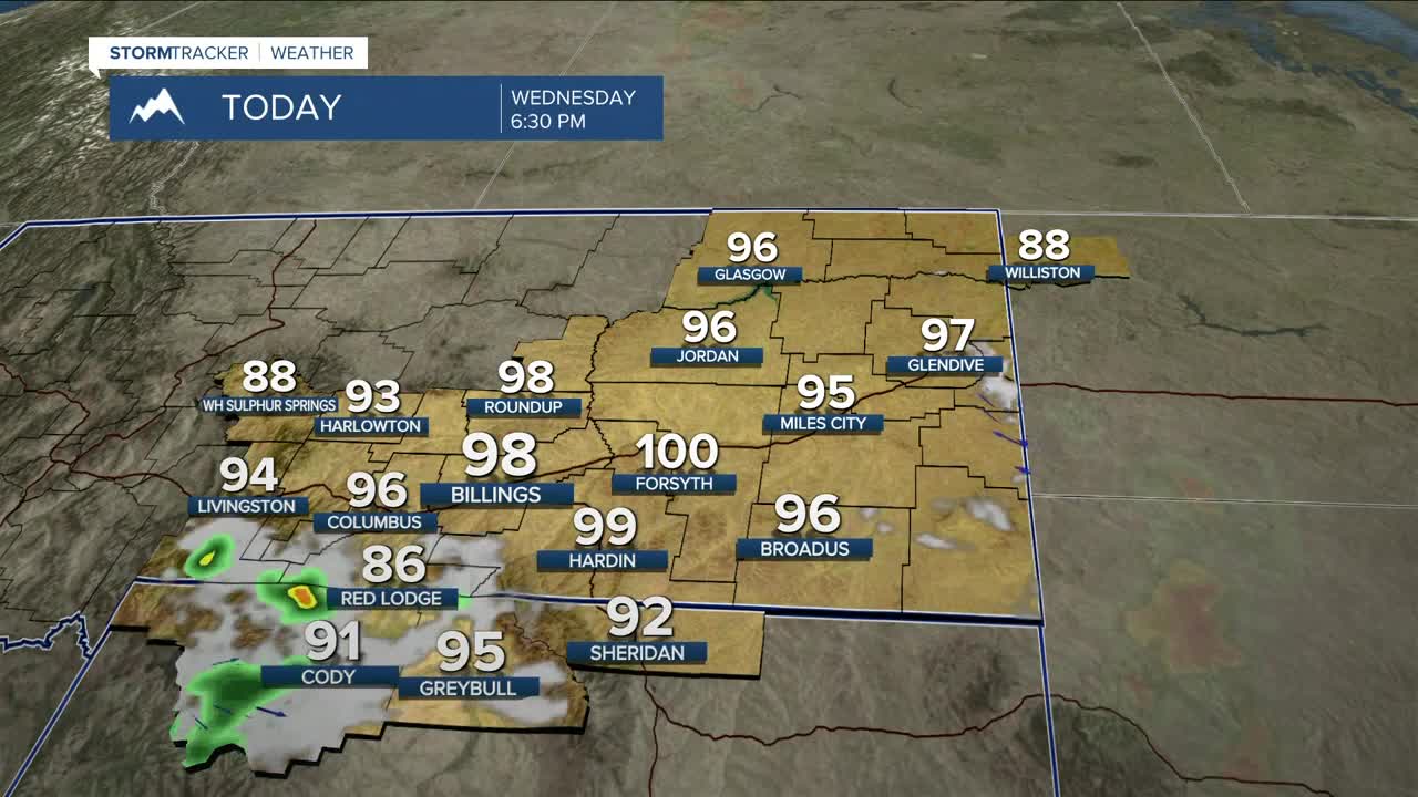


BILLINGS — Downslope flow will help make Wednesday the hottest day of the week with highs in the mid to upper 90s (maybe a few in the 100s) under lots of sunshine as high pressure keeps mainly dry conditions in place. A few isolated thunderstorms are possible during the afternoon and evening. Westerly winds gusting between 20-35 mph and low humidity values between 15-25% will heighten fire weather concerns, especially in the western foothills and parts of northwest WY. Don’t cause a spark!
A cold front will move through on Thursday, cooling temperatures down 5-10 degrees from Wednesday with highs in the mid-80s to near 90 degrees. Only a slight chance of rain is expected late in the day into the evening.
High pressure will keep conditions mostly dry on Friday through the middle of next week. Several disturbances could zip through, keeping a slight chance of daily showers and thunderstorms in the forecast. Daytime temperatures will range mainly from the mid-80s to low 90s during that period.
Nighttime lows will be in the 50s and 60s through the middle of next week.
Miller Robson
Q2 Morning Meteorologist
miller.robson@ktvq.com
