


BILLINGS — Over the immediate foothills of the Beartooth and Bighorn Mountains, including Red Lodge and Sheridan, moderate mountain wave activity is producing occasional gusts of 25-50 mph Wednesdasy morning, strongest along the Bighorn foothills. These winds will ease by late morning to early afternoon as upper-level winds weaken and a cold front approaches.
Strong, gusty west to southwest winds continue along the western foothills early Wednesday. From Livingston to Nye, the strongest winds occur through mid-morning, with gusts capable of exceeding 60 mph. From Big Timber to Harlowton, a weak inversion is keeping winds generally lighter early on, though occasional strong gusts may still reach the surface. Late morning into early afternoon, there will be a brief window ahead of the cold front where the inversion breaks and stronger winds aloft mix down, increasing the potential for gusts over 60 mph. Livingston is expected to see less impact from this second round as the approaching front weakens the pressure gradient and winds aloft turn more westerly.
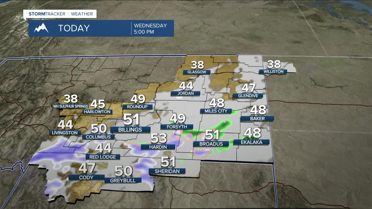
As the cold front moves through late Wednesday morning into the afternoon, breezy conditions will spread east into the plains, with gusts generally in the 20s to 30s mph. Scattered rain and snow showers will accompany the frontal passage. Outside of the foothills and higher terrain over the east, snow accumulations will remain light. Slightly higher totals are possible over the foothills and elevated terrain through early Thursday morning.
With above-normal temperatures, breezy conditions, and limited recent precipitation, grass fire concerns remain elevated. Avoid any activities that could create sparks.
Thursday and Friday stay unsettled, with occasional light precipitation over the plains and persistent light to moderate mountain snow. The most significant mountain snowfall will favor south- and west-facing slopes of the Absaroka and Beartooth Mountains, with the highest totals near Cooke City. Snow accumulations outside the mountains will remain minor.
Upper-level ridging builds in for the weekend into next week, bringing a return to warmer and mostly dry conditions. Weak disturbances may brush the region at times, leading to brief precipitation chances and occasional cooler temperatures over the east, though details remain uncertain.
Highs on Wednesday range from the mid-40s to low 50s, well above normal. Temperatures cool back to the 30s and low 40s for Thursday and Friday, then rebound into the mid-40s to low 50s again by Sunday as the ridge strengthens.
Miller Robson
Q2 Morning Meteorologist
miller.robson@ktvq.com
