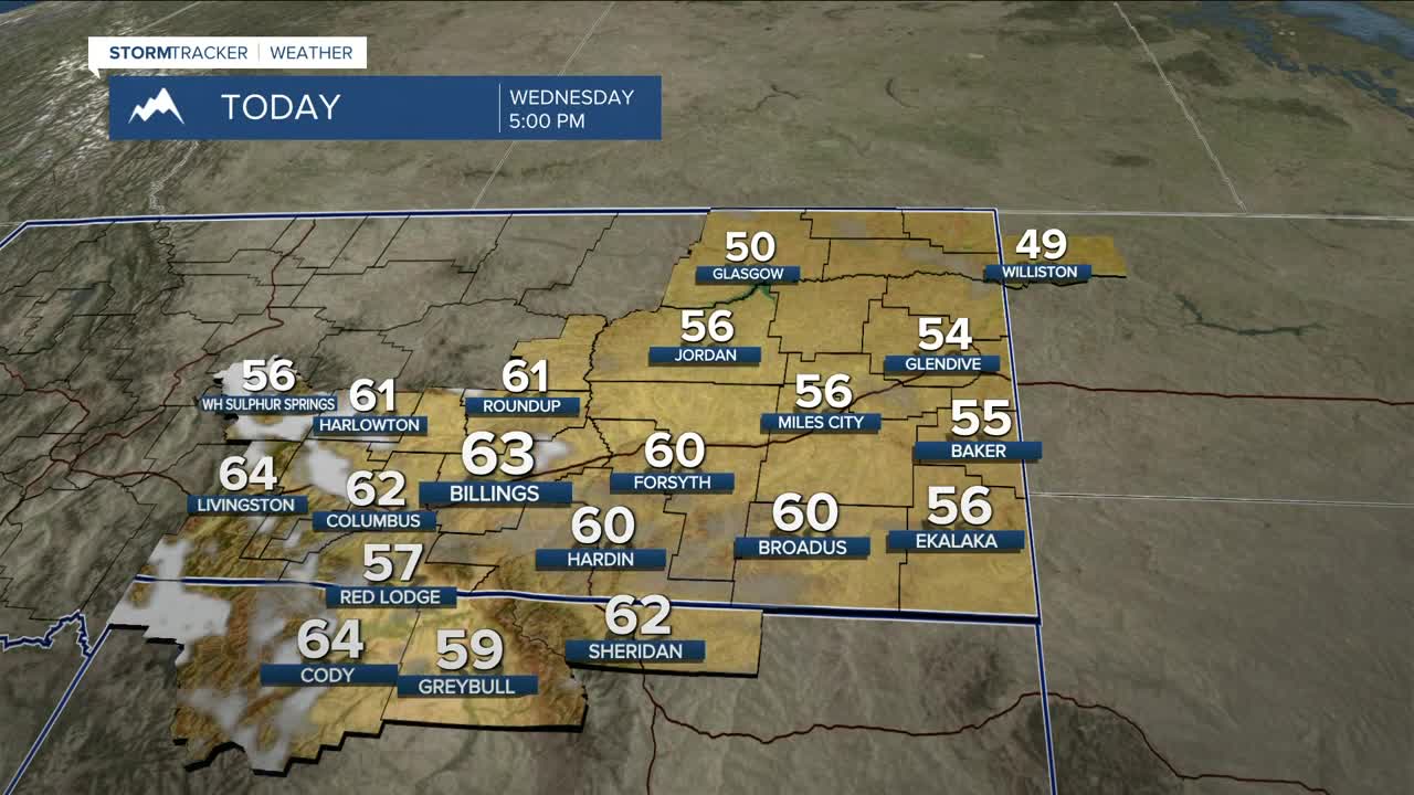


BILLINGS — Expect warmer-than-average weather through Friday (50s and 60s) as high pressure continues to dominate the area. Downslope winds will help warm temperatures even more on Thursday, with a few locations flirting with record highs, including Billings and Miles City. That could also be the case on Friday.
The ridge begins to break down on Friday as a Pacific system moves inland. It is expected to be a rather weak system by the time it makes its way to our area, so we’re only expecting a few inches of mountain snow and some light rain or snow showers at lower elevations Friday into very early Saturday morning. Daytime highs on Friday will range from the mid-50s west to the mid-60s east.
This weekend looks to stay mainly dry as high pressure moves back in, with highs cooling into the 50s on both Saturday and Sunday.
Our next Pacific system could arrive sometime Monday, but there’s still a lot of uncertainty — thanks in part to the remnants of Typhoon Fung-Wong near Taiwan, which are influencing the pattern across the Pacific. Models are still trying to figure out how that system might affect our area, but for now, we’ll go with a slightly better chance of rain or snow and cooler temperatures by Monday or Tuesday. We’ll keep you posted.
Miller Robson
Q2 Morning Meteorologist
miller.robson@ktvq.com
