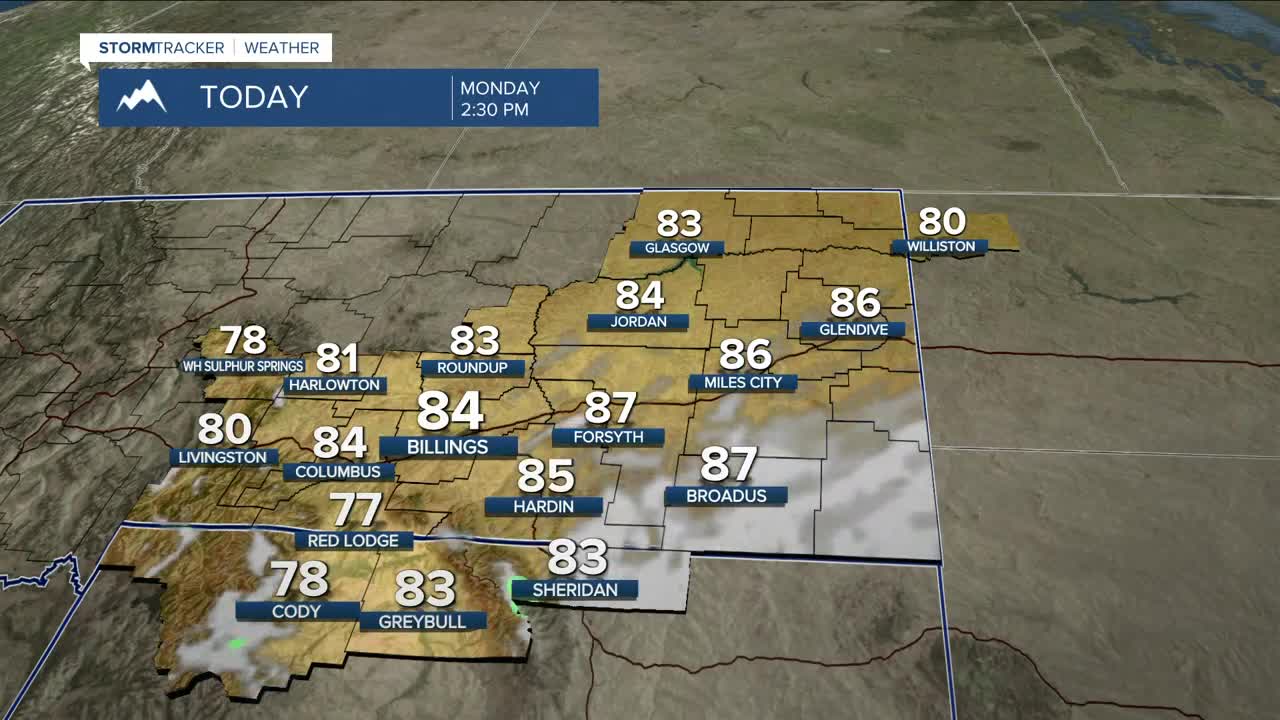


BILLINGS — It won’t feel like Fall for much of the week, as daytime temperatures will be around 10–20° above normal, with highs mainly in the low to mid-80s for most areas through Wednesday. Southwest flow will bring a decent chance of daily rain showers across the Absaroka–Beartooth Mountains and foothills through Wednesday. Only light accumulation is expected.
Looking ahead to Thursday and beyond, confidence is growing that a Pacific trough will kick off a pattern change to cooler and wetter weather starting Thursday, with highs in the mid-70s to low 80s before (still warmer-than-average) dipping to the low to mid-60s on Friday and Saturday. A wave dropping down from Canada is expected to knock daytime highs down into the mid-50s to around 60° on Sunday and into early next week.
The early Fall season’s first best chance of widespread mountain snow will arrive Thursday night, with snow levels falling to 8,000–9,000 feet in the Absarokas and Beartooths, where over 6 inches could accumulate by the end of the weekend. The Bighorns could also pick up several inches.
Nighttime lows will be in the 40s and 50s through Thursday night, then dip to the 30s and 40s Friday night through the weekend.
Miller Robson
Q2 Morning Meteorologist
miller.robson@ktvq.com
