


BILLINGS — MONDAY EVENING: Wrapping up our wintry day with rain and snow showers gradually fading as the evening progresses. Areas northwest of Billings might pick up an additional 1-2 inches of snow before the curtain falls completely.
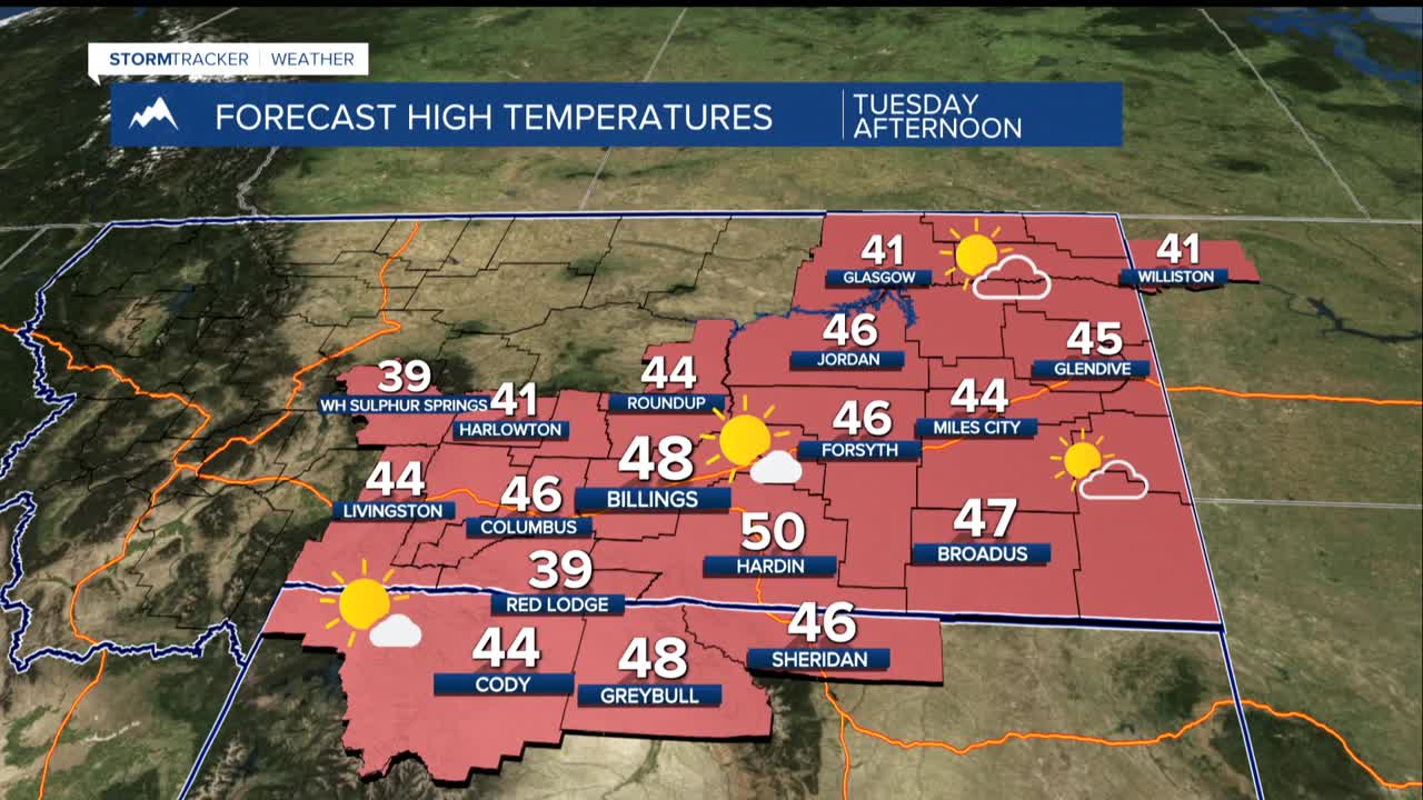
TUESDAY: Expect a peaceful day with temperatures climbing into mainly the 40s. That is noticeably cooler than last week, but still running 5-10 degrees warmer than typical this time of year.
WEDNESDAY: A passing weather system brings a 20-50% chance of precipitation to mountains and foothills. Mountain areas will see all snow, while lower elevations get a rain-snow cocktail. Any accumulations outside the mountains should stay light, with less than a 20% chance of more than an inch piling up.
THURSDAY & FRIDAY: The quiet, mild pattern continues with highs holding steady in the 40s to low 50s and dry for the lower elevations.
SATURDAY: A Pacific weather system begins moving in with clouds and isolated showers. Lows mainly in the upper teens and 20s. Highs stay 40s to low 50s.
SUNDAY & EARLY NEXT WEEK: Expect better odds for widespread precipitation with a 20-40% chance across the plains and 30-60% in the mountains and foothills. Western foothill areas should also brace for gusty, potentially strong winds as this new pattern settles in.
While way too far out for a lot of forecasting confidence, there are some early signals of a drop in temperatures late next week that could bring more snow as well. Check back for updates.
