

TONIGHT: Strong winds are already making their presence felt across the western foothills tonight. Near Livingston, a powerful pressure difference is driving gusts likely exceeding 60 mph. Big Timber and the Crazy Mountain foothills have a 60% chance of gusts topping 50 mph.
The Red Lodge foothills could see gusts in the 50-60 mph range, while areas near Sheridan are in the 40-50 mph zone. Bottom line: if you're in the foothills tonight, expect rough, potentially dangerous wind.
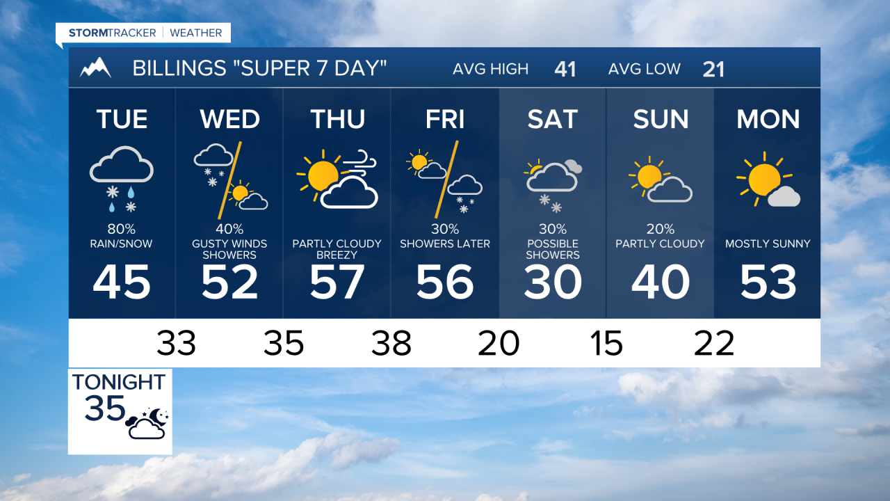
MONDAY INTO TUESDAY MORNING: The strong winds stick around through Tuesday morning before a cold front crashes the party. This front ushers in precipitation chances for most of the region, ranging from about 50% in eastern spots like Miles City and Baker, up to 90% in the mountains.
Expect a mix of rain and snow at lower elevations, while anything above 6,000 feet gets all snow.
TUESDAY: Tuesday starts mostly snowy before transitioning to rain and a rain/snow mix through the day. Warm temperatures keep most lower elevation spots at less than a 20% chance of picking up more than an inch of snow.
Foothills locations have a 20-60% chance of accumulating snowfall. Up in the Beartooth-Absaroka and Crazy Mountains, heavy snow is expected with a 60-100% chance of 12 or more inches.
WEDNESDAY: A secondary surge of moisture rolls in early Wednesday, potentially flipping precipitation back to snow for some areas. On top of that, the winds return with a powerful jet stream overhead, driving dangerous crosswinds across the region.
Gusty winds also spread out onto the plains Wednesday, so this isn't just a mountain and foothill concern. It's a rough day across the board.
WEDNESDAY THROUGH FRIDAY: Strong winds are expected to continue through the end of the work week as the powerful upper-level jet stream parks itself over the region.
FRIDAY INTO THE WEEKEND: A clipper system could deliver a dose of colder air and bring another round of precipitation by Friday into Saturday. There is also the potential for overrunning snowfall as colder air pushes in.
