


BILLINGS — Strong winds continue Tuesday morning across the western foothills, with gusts in the 50–70 mph range as pressure gradients tighten up and strong mid-level winds moved overhead. Winds will gradually during the afternoon. High Wind Warnings remain in effect through late morning or early afternoon.
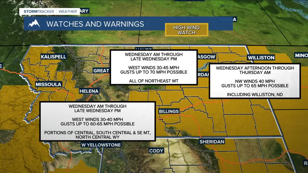
Any break in the wind will be brief. Pressure gradients tighten again Tuesday night into Wednesday ahead of a fast-moving clipper system, bringing another round of strong to potentially damaging winds along the foothills with gusts possibly over 60 mph along the US-191 corridor from Big Timber to Harlowton, with a moderate chance of gusts exceeding 70 mph. Livingston and Nye also be dealing with very high winds. A cold front Wednesday afternoon will spread gusty winds across the plains, with widespread gusts of 40–60 mph continuing into Wednesday night. A High Wind Watch is in effect for much of the area from tonight or Wednesday morning through Wednesday night.
The cold front will also bring scattered rain and snow showers Wednesday into Wednesday evening, with precipitation turning mostly to snow by late afternoon and evening. The Absaroka and Beartooth Mountains have a very good chance for significant snowfall, with at least 6 inches possible through Wednesday night. Another round of Pacific moisture arrives late Thursday into Friday, bringing a continued risk for heavy mountain snow and another potential round of strong foothill winds.
Temperatures remain mild today and Wednesday, with highs mainly in the 40s and 50s. Cooler air moves in behind the front Thursday, dropping highs into the 30s and 40s. A brief warm-up is possible Friday before cooler temperatures return for the weekend.
Miller Robson
Q2 Morning Meteorologist
miller.robson@ktvq.com
