


BILLINGS — Montana is bracing for another week of powerful winds that could create dangerous travel conditions, especially for high-profile vehicles. Snow melt will continue but a Wednesday cold front cools us down.
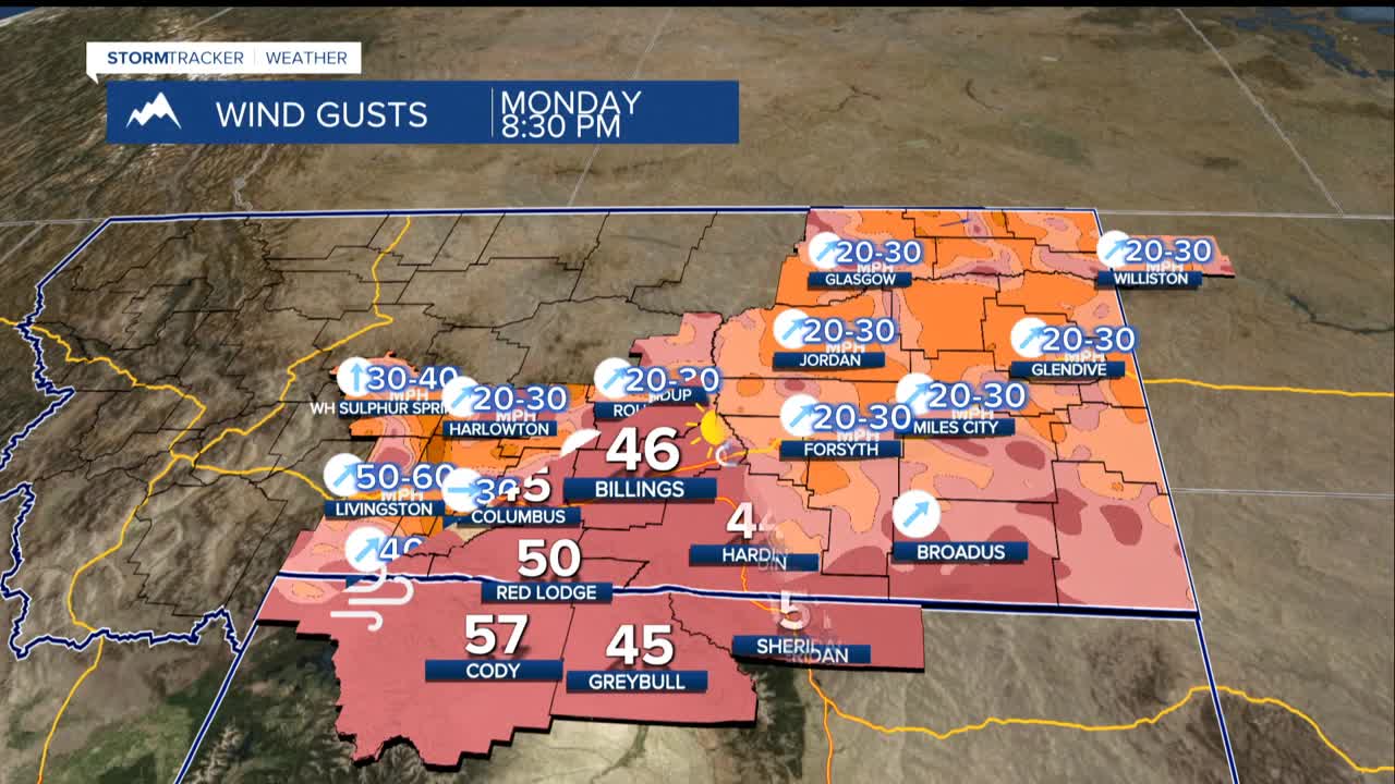
Strong winds begin Sunday night in gap areas like Livingston, then spread to the US-191 corridor (Big Timber to Judith Gap) Monday night through Tuesday. Wednesday looks to be the worst day, with winds potentially causing some damage.
Gusts could reach 50-70 mph in many areas, with some of the mountain foothill locations possibly seeing gusts to 80 mph. Drivers should be especially cautious on US-191 between Big Timber and Judith Gap, where cross-winds could be particularly dangerous.
The warmer temperatures will reaching the 40s and 50s will continue, causing rapid snow melt. Flooding issues should be avoided since the ground can still absorb the water, but there could be areas of standing water and muddy rural roads.
There is a good chance for light rain and snow showers Wednesday as the wind system moves through. More periods of strong winds are possible through the end of the week.
Residents should secure outdoor items and avoid unnecessary travel during peak wind periods, especially if driving high-profile vehicles like RVs or towing trailers.
