


BILLINGS — Through the late afternoon and evening Monday, strong thunderstorms are forming over the mountains and then moving eastward. The conditions are right for these storms to pack a punch, with plenty of moisture in the air—about 130% to 140% more than usual for this time of year. This could mean heavy rain, hail, and strong winds.
Areas like Wheatland, Golden Valley, and Musselshell counties to the north of Billings are likely to be hit hard and are currently under a Severe Thunderstorm Watch. Areas that received heavy rain Sunday night where the ground is already soaked have increased risk of flooding.
Most of the storm activity should calm down by midnight, but a few leftover storms might hang around. Looking ahead to Tuesday, the rain and storm activity is expected to continue with even more moisture in the air. There’s a good chance of thunderstorms again, especially in the foothills, with conditions ripe for intense storms that could produce heavy rain.
Especially over areas that have already seen a lot of rainfall or over areas burned by wildfires last year, heavy rain could lead to flash flooding, so it's important for residents to stay alert.
As we move towards midweek, we can expect more rain and thunderstorms. These storms might be slow-moving, which could mean more heavy rain in some spots. Windy conditions are also possible as a weather front moves through.
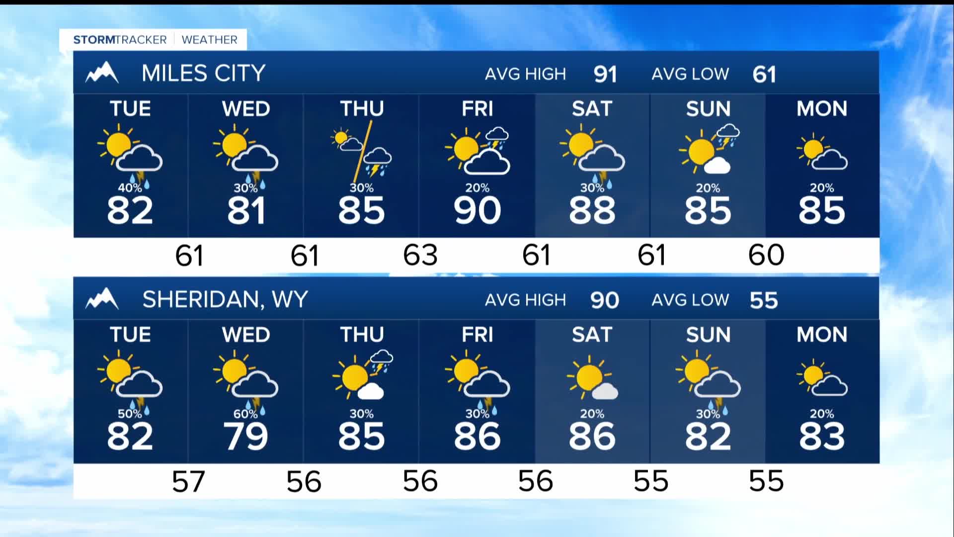
Temperatures are going to stay cooler than usual this week, so expect highs in the upper 70s and 80s, with slightly warmer temperatures towards the weekend.
