

BILLINGS — Tuesday evening, there is a renewed possibility of severe weather in the area. A weather system is moving east through is expected to create some storm activity. Thick cloud cover is reducing how many storms actually form.
Good lift, plenty of moisture, and varying winds at different heights suggest there could be strong gusts and hail. However, where and when the storms develop will greatly influence their intensity since the weather patterns suggest they might split apart.
Tuesday night, as the weather system moves out, low clouds could return, resulting in fog in higher areas.
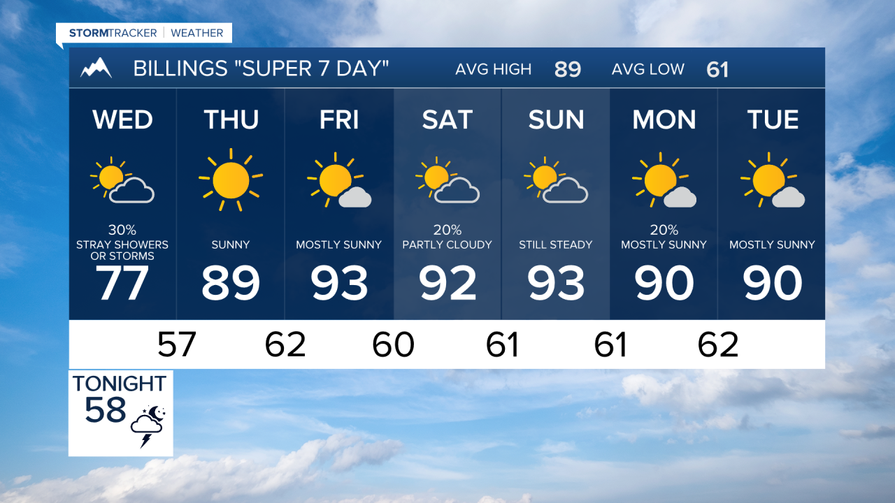
Looking ahead to Wednesday, another strong weather system is expected, potentially bringing more severe storms if the skies clear early enough. There could be enough energy in the atmosphere for very strong storms, particularly around the Bighorn Mountains.
Tuesday will be cool for late July with highs mainly in the 70s. Thursday, highs will reach mainly the 80s and turn drier. Then a steady weather pattern begins with highs in the upper 80s and 90s with only isolated late-day storms or showers.
