


BILLINGS — Wednesday afternoon, a small weather system near the Montana-Wyoming border is bringing scattered showers and storms. As it moves east, a stronger system is set to come in from the Montana-Alberta border, which could also spark more storms.
However, severe weather isn't expected, just some gusty winds with the possibility of strong gusts up to 35 mph, especially in hilly areas. While there are some fire risks due to lower moisture and strong winds, recent rainfall has mitigated potential dangers.
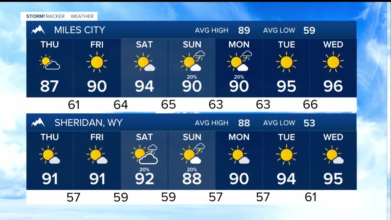
Thursday, a cold front will pass through in the morning, bringing drier air by the afternoon. You might see some hazy skies due to smoke being blown into the region, but conditions will improve after the front moves through.
Looking ahead to the rest of the week, expect typical August weather with a strong ridge of high pressure over the Rockies and high plains. There will be lower chances of storms on Friday, but Saturday could see more storm activity as moisture increases, especially in the mountains.
Sunday and Monday might bring increased thunderstorm activity with the potential for gusty winds and heavy rain.
By Tuesday and Wednesday, the dry conditions will likely return, but temperatures could rise significantly, possibly reaching the low 100s in some areas. Summer isn’t over yet.
